August 6
Camp Name
No camp name recorded
Daylight (Hours)
13 hours / 56 minutes
Brightness of the Moon
51%
Distance Traveled (Leagues)
2.5 leagues
Distance Traveled (Miles)
6.5 miles
Water Resources
San Juan River
Journal Description for August 6th
On the 6th in the afternoon we set out from El Paraje de Nuestra Señora de las Nieves, downstream and to the west, and after traveling two and a half leagues of bad terrain we halted by the river’s edge. Don Bernardo Miera had been having stomach trouble all along and this afternoon he got much worse, but God willed that he got better before morning the next day so that we could continue on our way. Today two leagues and a half. 45About 6.5 miles.
Scroll to the bottom to view photos.
Miller Report Summary
A short day’s march on August 6 took the company westward through the meadowland along the north bank of the San Juan. The campsite, now covered by the waters of Lake Navajo most of the year, was located about four miles east of Arboles—approximately one mile west of Sandoval Canyon.
Notable Event
Illness of Don Bernardo Miera.D&E and Crew Activity
After traveling two and half leagues down river, they stopped because Don Bernardo Miera (the map maker) was having stomach trouble all morning and it had gotten worse, so they had to stop.DEEEP’s Field Notes
Copyright © 2024, DEEEP Colorado. All Rights Reserved.
August 6, 1776
By Carol Hunter (DEEEP Coordinator) with assistance from several DEEEP Members
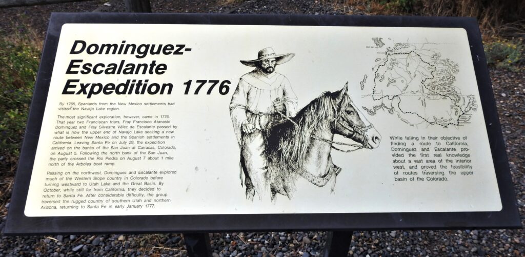
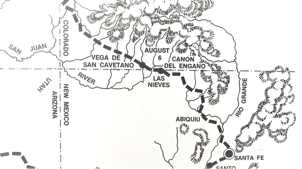 The map below is taken off an interpretative sign found at the entrance to the Visitor Center at the Navajo State Park. It shows what is thought to be the location of the August 6, 1776 campsite.
The best way to view this campsite is to first travel to the August 5, 1776 campsite and then come back six and half miles. You can also turn off Highway 151 onto County Road 500. Drive to Sandoval Creek which is about six and half miles. Turn around here and travel back west about a mile. See photo of Sandoval Creek.
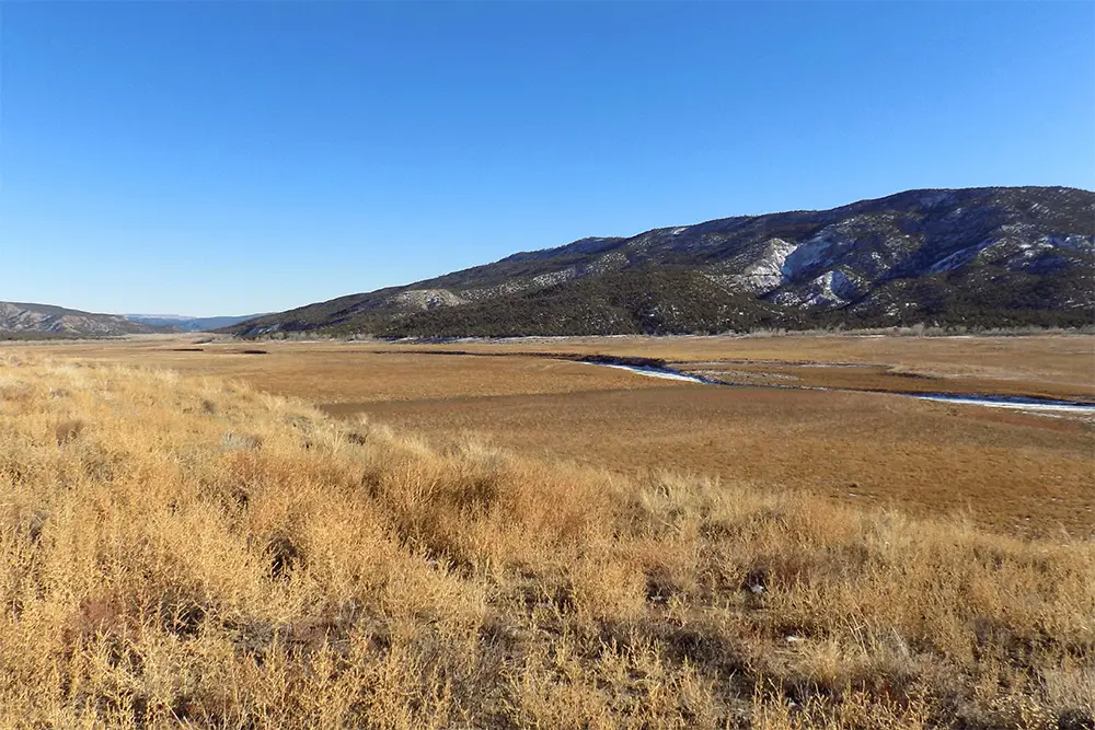
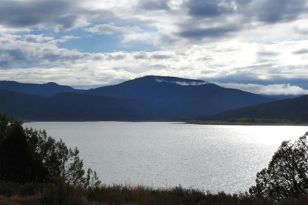
I visited what is thought to be the route between August 5th and 6th of 1776 during July 2020 and March 2022 to photograph the route that Auerbach, Bolton, and the Miller team suggested. A photo taken July 25, 2020 which shows the Navajo Reservoir full, covering where the San Juan River would have flowed near this camp site. The dam construction began in 1958 and finished in 1963 which was after Auerbach (1943) and Bolton (1950) wrote their reports. I returned on December 19, 2022 and the reservoir was close to being empty. It clearly showed where the San Juan River flowed. The Journal describes the terrain as being “bad” and “we halted by the river’s edge” because Don Bernardo Miera had severe stomach pain and they stopped hoping he could rest and be better the next day.
The landscape has also changed because of heavy oil and gas activity. With the help of the Southern Ute Police Department, I was shown maps of the area and it is considered having checkboard ownership. This means that ownership can belong to the State, the Southern Utes or is private land. I was told that a permit is needed to step on the Reservation even to take photographs. So, all photographs were taken from the road.
I measured the distance from the approximate campsite location for August 5th to the location that was a distance of 6.5 miles. The campsite location seems to be located 1 mile west of Sandoval Canyon/Creek.
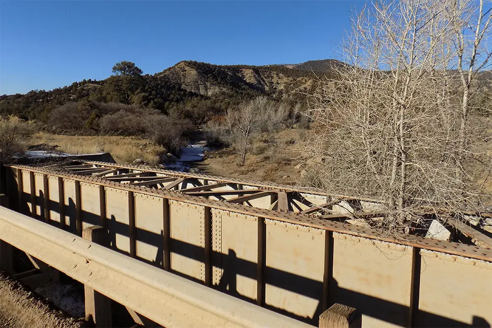
This creek is easy to identify as there is a large steel beam that crossed the creek beside the road. The photos for this campsite were taken from the road facing where the San Juan River flows.
There are several interesting things found in this short Journal entry.
The first for me was the fact that they did not mention the name of the river where they “halted by the river’s edge”. Reading the Journal for August 5th and 7th, it seems that Escalante thought the river was the Navajo not the San Juan. On August 5th, Escalante had traveled by himself to see the confluence of the San Juan and Navajo Rivers. The August 7th Journal entry says that they arrived at the “La Piedra Parada, very near to where it joins the Navajó”. This leads one to believe that Escalante thought that the Navajo River was the predominate river instead of the San Juan River. A photo taken December 16, 2022 shows the Navajo Reservoir almost empty. It also shows how the river might have looked in 1776 where it is thought that the Piedra and San Juan met.
The next discovery that I found in this Journal entry was the sentence that said Don Bernardo Miera had stomach problems and he had gotten worse. “…but God willed that he got better before the next morning so that we could continue on way”. The word “willed” seemed to jump off the page. Recently DEEEP member, Linda Adkins, and I were going over the maps for the days she was working on. As she was leaving, she said “I don’t think the Journal entries were written on the day they traveled.” To be honest, I had never thought about it.
Now working on August 6th, the word “willed” caught my attention. It was past tense. I don’t speak Spanish but there are several DEEEP members who do. I talked with some of those DEEEP members and read the sentence to them and asked what they thought. They reassured me that most likely it had been written later. Then I emailed Donna Tang asking about Spanish tenses. She returned an email explaining the Spanish tenses.
“Spanish does indeed have ways to indicate tense, and it has more ways of expressing past tense than English has. When transcribing and translating we have to be very very (VERY) careful to render the tenses correctly and that’s not always easy because they didn’t use accents and punctuation in the 18th century, the way we do today. So, I was prepared to have to go look at the original document if it was unclear.
But…no worries! The Spanish is absolutely clear: the word used is “quiso,” which is unmistakably the preterite tense of “querer” (to will), indicating an action completed in the past. It says “God willed.” All the other verbs in that passage are also preterite, which has 2 forms. I looked at the entries for other days, and the preterite is consistently used, so I totally agree with the other member that Escalante (or someone else using his notes) wrote this AFTER the fact.”
Donna has written two sidebars and you are encouraged to read them. In it she explains that the diary/Journal was probably not written by Escalante himself, but is a report filed by someone else based on Domínguez’s and Escalante’s notes. The earliest known copy of the Journal is dated January 3, 1777, a day after they arrived back in Santa Fe. It is in the handwriting of Fray José Palacio, who was the secretary for Father Domínguez.
