August 30
Camp Name
Saint Rose of Lima
Camp Name (Spanish)
Santa Rosa de Lima
Brightness of the Moon
98%
Distance Traveled
4 leagues / 10.5 miles
Daylight
13 hours / 8 minutes
Water Resources
Gunnison River and Leroux Creek
Journal Description for August 30th
On the 30th in the morning the interpreter Andrés and the guide Atanasio arrived with five Sabuaganas and one Laguna. After we had regaled them with plenty of food and tobacco, we informed them of our purpose, which was to pass on to the pueblo or pueblos of the Lagunas (the Yutas had told us that the Lagunas dwelt in pueblos like those of New Mexico), telling them that, since they were our friends, they should give us a good guide who would conduct us as far as these peoples and that we would pay him to his satisfaction. They replied that to go to the place we were trying to reach there was no other trail than the one passing through the midst of the Comanches and that these would impede our passage and even deprive us of our lives — and finally that none of them knew the country between here and the Lagunas. This they repeated many times, insisting that we had to turn back from here. We tried to convince them, first by arguing and then by cajoling, so as not to displease them. Then we showed the Laguna a woolen blanket, a big all-purpose knife, and white glass beads, telling him this is what we were giving him so that he would accompany us and serve us as a guide all the way to his country. He agreed, and the things mentioned were turned over to him.
When the Sabuaganas saw this, they quit posing difficulties and now acknowledged that some of them knew the way. Following all this, they strongly insisted on our going over to their encampment, saying that the Laguna did not know the trail by any other way. Well did we know that it was a new ruse to detain us and longer enjoy the kindnesses we were doing them; for to as many as came there — and today they were plenty— we gave them to eat and to smoke. However, so as not to give them cause for displeasure or lose such a good guide as we had acquired, we yielded and agreed to go over.
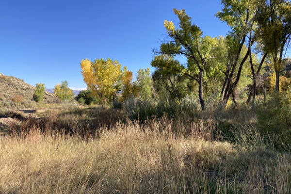
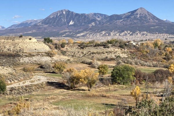
This afternoon we left Santa Mónica, crossed El Río de San Xavier,137The Gunnison River. in which the water reached the mounts well above the shoulder blades, climbed a hill, and, over broken terrain but tractable and without stone, traveled upstream and east-northeast for two leagues; then, after going another two northeast over country not quite as broken up but with some sagebrush, a lot of small prickly pear cactus, and finely ground black lava, we halted at the edge of a little river which we named Santa Rosa.138Known today as the Leroux Creek. The campsite was on Leroux Creek, some 12 miles from the last campsite. It rises in La Sierra del Venado Alazán, on the southern flank of which we now find ourselves, and enters into that of San Xavier. Here it has a medium-sized meadow of good pasturage and a scenic grove of white poplar and scruboak. Today four leagues.139Ten and a half miles. The Sabuaganas and the Laguna spent the night with us.
Scroll to the bottom to view photos.
Notable Event
On the morning of August 30th, 1776 the interpreter, Andrés Muñiz, and the Ute guide, Atanasio, returned to the Santa Mónica campsite with five Sabuagana Utes and one Laguna Ute. After discussions with the Utes, the Laguna Ute agreed to guide the expedition to his homeland in the Utah Lake area in Utah. However, the Sabuagana Utes insisted that the expedition travel first to their encampment, as they argued that the Laguna Ute only knew the way back from that encampment. While knowing that this was a ruse to deter and delay them, Domínguez and Escalante still agreed to this plan so that they did not displease the Utes and lose their guide. The expedition then traveled east across the adobe badlands from the Santa Mónica campsite on the Río de San Francisco Xavier (or Gunnison River) to the Santa Rosa de Lima campsite on the little river named El Río de Santa Rosa or the modern named Leroux Creek.
Miller Report Summary
Seeking a main camp of the Sabuagana Utes, the company crossed to the north bank of the Gunnison and continued eastward roughly following the route of present Colorado Highway 92. The night of August 30 found them camped near the mouth of Leroux Creek slightly west of present Hotchkiss.DEEEP’s Field Notes
Copyright © 2024, DEEEP Colorado. All Rights Reserved.
August 30, 1776
By Sheila Maki, David Bradford, Joe Oglesby and Hank LeValley
(Members of the Hotchkiss-Crawford Historical Society and part of DEEEP)
Our group spent August 19, 2023 scouting and evaluating this route and campsite. We believe the Domínguez-Escalante Expedition followed the basic route of the current Colorado State Highway 92 (SH 92) at least to Roger’s Mesa where they trended to the northeast and dropped down to Leroux Creek where the IX Gulch comes in. This is based on Escalante’s description that they “Traveled Northeast two more leagues over less rough country with sagebrush, prickly pear cactus and finely ground black lava” and the fact that it was difficult to drop into Leroux Creek from Roger’s Mesa before the roads were constructed – current SH 92 and J80 Road, the original road into Hotchkiss. In addition, since Domínguez and Escalante believed that Leroux Creek flowed into the Río San Xavier (Gunnison River), they must have traveled high enough that they could not see the Gunnison coming in from the south in the Gunnison Gorge. It is not readily apparent even from SH 92, unless you are looking for it. The drop into Leroux Creek from Roger’s Mesa where IX Gulch enters is not traversed by 3300 Road. However, the slope into the drainage would be easily negotiated by horses. We believe the campsite was located on the east side of the creek near where IX Gulch comes in. We identify the site as being located in T.14S., R.93W., SE¼NW¼ S.25, 6th P.M. or 38°48’27” N, 107°44’25” W. This site is currently privately owned. The distance from the Santa Mónica campsite to the Santa Rosa de Lima campsite on Leroux Creek following this route, is 13 miles, as measured with the measuring tool on the Delta County GIS website.


