August 22
Camp Name
Saint Philip
Camp Name (Spanish)
San Felipe
Brightness of the Moon
51%
Distance Traveled
4 leagues / 10.5 miles
Daylight
13 hours / 27 minutes
Water Resources
San Miguel River
Journal Description for August 22nd
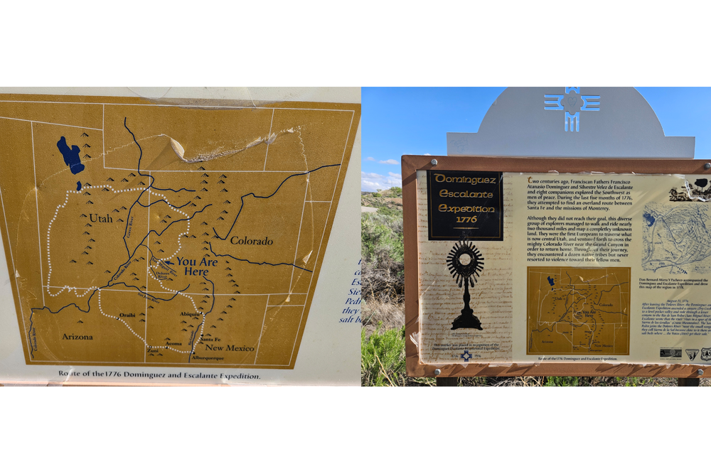
On the 22nd we left El Paraje de San Luis, crossed the river, went up a rather high and steep incline, but not too rocky, and started over an extensive mesa which is like a piece off La Sierra de los Tabehuachis.103The Uncompahgre Plateau. We went over it northeast for two leagues, east-northeast for more than half a league, east-southeast for another half, and descended the mesa down another steep but short incline, and it is the one which Don Juan María de Ribera104In 1765 he headed an expedition from Santa Fe to investigate the existence of silver mines reported in the La Plata Mountains and on that trip explored and traded at least as far as the present Gunnison River. Don Joaquín Laín and Andrés Muñiz, interpreters and guides with the Domínguez-Escalante party, had previously accompanied Rivera on his explorations. Rivera subsequently made two and possibly more expeditions into this section of Colorado, apparently penetrating for a considerable distance beyond the Gunnison River, for the journal notes that two of Rivera’s companions, Pedro Mora and Gregorio Sandoval, on one of these expeditions thought they had traveled as far as the great Tizón (Colorado) River. As a result of Rivera’s trips other expeditions traveled into this region for the purpose of prospecting for precious metals and trading with the Indians. (See Herbert S. Auerbach, Escalante’s Journal, p. 42.) Professor Donald Cutter of the University of New Mexico has recently located the Rivera journals of these expeditions into Southwestern Colorado in the Servicio Histórico Militar, Madrid, Spain. He is preparing them for publication at this time. in his diary dwells on as being very trying. Then we traveled along the edge of El Río de San Pedro (upstream) for a league toward the northeast. We paused for a rest, and they went on to reconnoiter what we were to travel in the afternoon — by getting away from the river now if there was a water source handy, and if not, the following day. Those who had gone out for this purpose returned late, and so we slept [overwritten: ended the march] at this spot, which we named San Felipe.105On San Miguel River, just west of where Colorado State Highway 90 goes today and not far from the electric generating plant on the river. They passed through the site of the present town of Nucla and reached the San Miguel at about the site of the substation and continued along the river to the campsite of San Felipe (Saint Philip). Today four leagues.106Ten and a half miles.
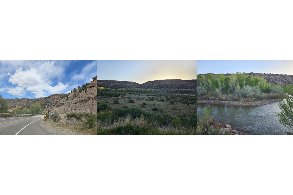
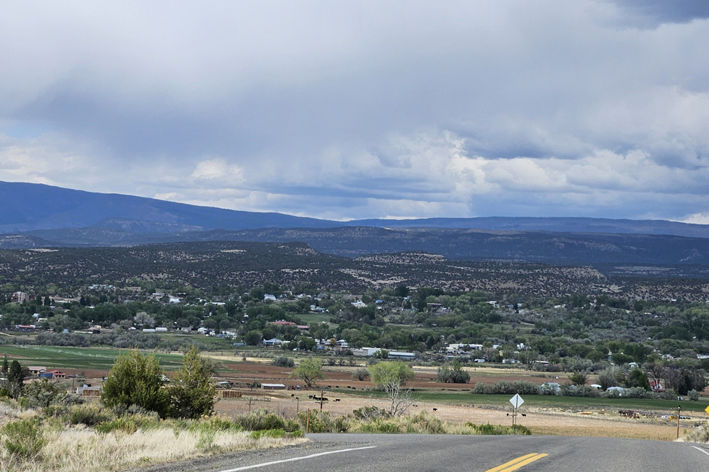
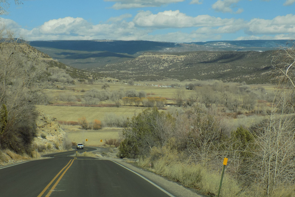
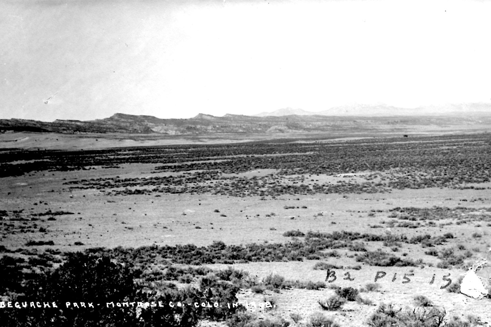
Scroll to the bottom to view photos.
Notable Event
Following Juan Maria Rivera’s maps, the party traversed the same “Steep but short incline” mentioned by Rivera.Miller Report Summary
After camping on the San Miguel with good pasturage, the expedition climbed out of the river channel to the east, passed through present Nucla, and turned southeast to again reach the San Miguel and camp (August 22) in its meadows a couple of miles upstream from the present electric substation.DEEEP’s Field Notes
Copyright © 2024, DEEEP Colorado. All Rights Reserved.
August 22, 1776
 Coordinator’s notes:
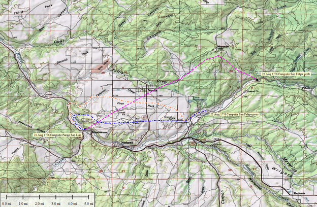
The map showing possible routes along with research notes for the Expedition on August 22, 1776 can be confusing. The orange dashed line is what is suggested in the footnotes found in Domínguez-Escalante Journal edited by Ted J. Warner. We know his route as he mentions an electrical plant which was located at the top of Calamey Draw for a very short time. Most likely it was gone by the time he edited the Journal. The power plant which is described at the bottom of Rivera’s Hill was the coal plant on the San Miguel River, is also gone. This seems to be the only time in Colorado that Warner disagrees with the Miller report. The Journal does not say what direction they went once they left the river. It says, they climbed a steep incline, passed over an “extensive mesa” and then down a steep but short incline which the crew thought was the same one referred to Rivera’s in his Journal. Both the orange and blue lines come down in the same area that could have been the one referred to in Rivera’s Journal.
The Miller report reads: “the expedition climbed out of the river channel to the east, passed through present Nucla, and turned southeast to again reach the San Miguel and camp (August 22) in its meadows a couple of miles upstream from the present electric substation.”.
The magenta line uses: “On the 22nd we left El Paraje de San Luis, crossed the river, went up a rather high and steep incline… and started over an extensive mesa which is like a piece off La Sierra de los Tabehuachis.103 We went over it northeast for two leagues, east-northeast for more than half a league, east-southeast for another half, and descended the mesa down another steep but short incline, and it is the one which Don Juan María de Ribera” describes in his diary.
What is important to remember is that the year 2026, is the 250 Anniversary of the Expedition passing through Colorado. As we celebrate this Anniversary, it is important to remember that 250 years is a long time ago and many things including landmarks and technology have changed. DEEEP’s researchers and those that came before and those that will come after, can only provide what they feel is the best suggested route. No one remains to tell who is right.
By Glade Hadden: PhD: Archaeologist, BLM (retired)
Glade’s suggested route is a blue dashed line
The party spent the night of August 21st at a campsite on the banks of the San Miguel River (called El Rio de San Pedro = Saint Peter’s River). The site would have been a welcome pasturage for the party’s livestock with plentiful grass and abundant water. Leaving their campsite at El Paraje de San Luis, the party turned downstream along the San Miguel River looking for a pathway northeast. Finding a steep but passable canyon (likely the same route used by Juan Maria Rivera in 1768) the party turned northeast to the top of the mesa. From there, they turned east along the top of the mesa following Rivera’s route to a steep hill leading back down to the San Miguel River well upstream from where they had left the same river that morning. (Information taken from Steve Baker’s book on Rivera) Traveling an additional league east upstream, the party paused for a rest, sending out scouts to explore the land ahead. As the scouts were late in returning, the party camped on August 22nd for the night in that spot, which they named San Felipe.
*Starting point – Junction of Highway 90 and Highway 141. Immediately after turning onto Highway 141, look to your right as you cross a low hill and you will see the general area of the El Paraje de San Luis campsite below. Drive 1.8 miles west on Hwy 141 to the junction with Montrose County Road CC (Calamity Road). CC Road winds its way northeasterly to the top of the mesa before turning directly east. CC road more-or-less parallels the original Domínguez-Escalante route, which likely ran across the flats somewhere between CC Road and the Montrose County’s Hopkins Field Airport From the turnoff on Highway 141 to Nucla’s Main Street is 4 miles. Continue across Main Street to the east, still on CC Road. At 5.5 miles (from 141) CC Road turns south as County Road 3000. 1.3 miles further south, 3000 road turns back east as County Road DD31. From there to the top of the hill (described by Rivera) is 2/10 mile. The county road closely follows the route pioneered by Rivera in 1768 and later followed by Domínguez and Escalante in 1776.
When you reach the bottom of the hill, the county road DD31 becomes county road DD30, switches sharply north and crosses the San Miguel River, while the original Domínguez route continues easterly on the north side of the San Miguel River.
By Tony & Linda Adkins: DEEEP Map Makers
Suggested route is shown as a magenta dash line
The Domínguez-Escalante Journal (Chavez and Warner) on 22 August says “we left El Paraje de San Luis, crossed the river, went up a rather high and steep incline, but not too rocky, and started over an extensive mesa which is like a piece of La Sierra del los Tabehuachis. We went over it northeast for two leagues, east-northeast for more than half a league, east-southeast….” They did not go east. Linda thinks that the rocky descent near the reclaimed powerplant is not the same as the hill that gave Rivera problems on the 10th. Baker’s book infers that “Rivera’s hill” was in the descent off of Davis Mesa near Bedrock. The trail currently in that area is known as the Ketchemup Trail.
As an aside, let me comment. From reading the Domínguez-Escalante Journal, the Friars seemed to be pretty diligent about their metes and bounds, plus if they are traveling upstream, downstream, uphill or downhill, they note it. I’ve seen distances as short as a quarter of a league (0.66 mi) with compass bearings 1/16 of a circle (ex. east-southeast), or a tolerance of 11.5 degrees on either side of the true bearing. Nowhere in the Journal of 22 August is there any comment about starting off downstream on a northwest heading and traveling over a half a league (actual distance from the junction of 141/90 to the Calamity Bridge is about 1.7 miles).
