August 23
Camp Name
Guide’s Fountain or The Spring of the Guide
Camp Name (Spanish)
La Fuente de la Guía
Brightness of the Moon
61%
Distance Traveled
6 leagues / 15.75 miles
Daylight
13 hours / 25 minutes
Water Resources
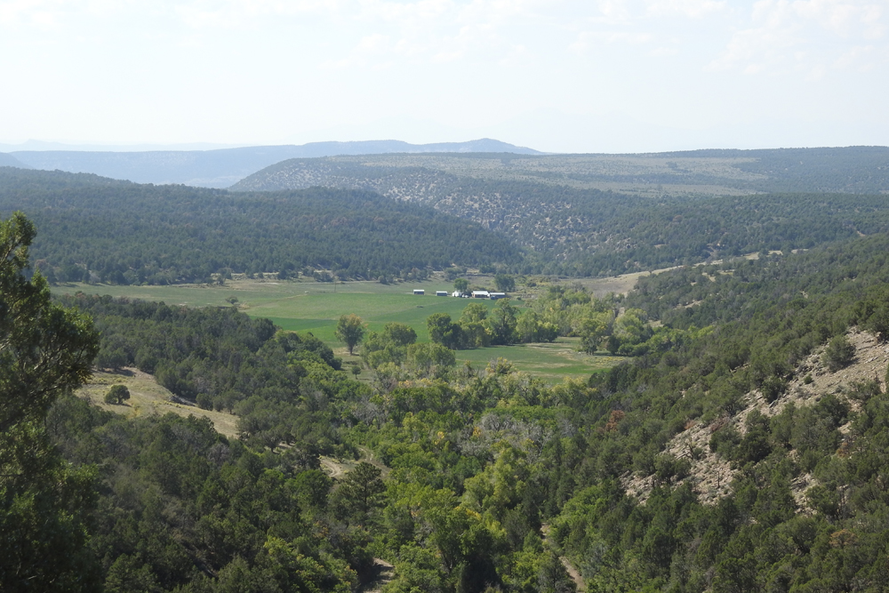
A flowing spring near the abandoned pueblo
Journal Description for August 23rd
On the 23rd we left El Paraje de San Felipe (on El Río de San Pedro), went up a hill, and along the foot of La Sierra de los Tabehuachis (thus called for being inhabited by the Yutas of this name) we traveled for four leagues, which, because of the turns we made, would be two east from San Felipe. We already had left the said Río de San Pedro, which rises in La Sierra de las Grullas, at its small branch which continues north after the one called Sierra de la Plata and flows northwest and west until it joins the Dolores near the small Sierra de la Sal107The La Sal Mountains.— so called for there being salt beds next to it from which, as they informed us, the Yutas hereabouts provide themselves. It is a medium-sized river.
We stopped to rest near a small source of ever-flowing water coming down from the sierra and on a level sagebrush stretch, which has a narrow valley with good pasturage at its southern end and forming ahead of it something like a low ridge. On top of this are the ruins of a small and ancient pueblo,108This ruin has not been identified by modern-day researchers. the houses of which seem to have to have been made of the stone with which the Tabehuachi Yutas have fashioned a weak and crude rampart. Here once more we found the mounts some pasturage, which had become scarce since El Paraje de la Asunción by El Río de Dolores until today, for the earth was scorched and dry enough to show that no rain had fallen all summer.
It started to rain by afternoon and ceased within a little more than an hour, and we continued our day’s march by ascending La Sierra de los Tabehuachis along a high hill, which was ruggedly steep in places; then, after one league of travel to the northeast and another to the east, we were overtaken by a Tabehuachi Yuta, who was the first one we had seen in all that we had traveled until now (since the first day’s march from El Pueblo de Abiquiú, when we encountered two others). In order to talk with him at leisure, we halted near the beginning of the water source where we had rested, and here we named it La Fuente de la Guía.109Cottonwood Creek is probably the best permanent water in the area because of the area it drains; they went generally northeast and east from Cottonwood Creek and then reached it again near its source and camped there. La Fuente de la Guia means “the guide’s fountain,” or the guide s source” of the stream— in other words, a “spring.” We gave him something to eat and to smoke, and afterward through the interpreter we asked him various questions about the land ahead, the rivers, and their course. We also asked him where the Tabehuachis, Muhuachis, and Sabuaganas were.
At first he denied knowing anything, even the country where he lived. However, after he had lost some of the fear and suspicion with which he conversed with us, he said that the Sabuaganas were all in their own country and that soon we would be meeting them; that the Tabehuachis wandered scattered about throughout this sierra and its surroundings; that the rivers, from the San Pedro to the San Rafael inclusive, flow into the Dolores, and the latter joins with the Navajó. We suggested to him that he might want to guide us as far as the encampment of a Sabuagana chieftain who our interpreter and others said was very fond of the Spaniards and knew much of the country. He consented on condition that we wait for him until next day in the afternoon; we agreed to wait for him, both to acquire him as a guide and lest he came to suspect something of us which would disturb him and the rest. Today six leagues.110About 15¾ miles
Scroll to the bottom to view photos.
Notable Event
Meeting the Tabeguache Ute who later served as their guide. Pausing near Cottonwood Pueblo.D&E and Crew Activity
The Tabeguache Ute Guide (Atanasio) joined the expedition.Miller Report Summary
Because of the many bends of the San Miguel River, the padres decided to ascend the Uncompahgre Plateau. Their route was generally parallel to Colorado Highway 90. Probably on Cottonwood Creek they encountered a Ute Indian and pitched camp (August 23) in order to allow time to establish friendly relations. The Ute agreed to lead the company to his people and guided them from that point to the Uncompahgre River.DEEEP’s Field Notes
Copyright © 2024, DEEEP Colorado. All Rights Reserved.
August 23, 1776
Coordinator’s Notes:
The Uncompahgre Plateau Research team was made up of Glade Hadden, Linda Adkins, Bob McKeever and Tony Adkins. They provided the research for August 23 – 26, 1776. The team came up with two different theories. The first is provided by Glade Hadden and the second by Linda Adkins.
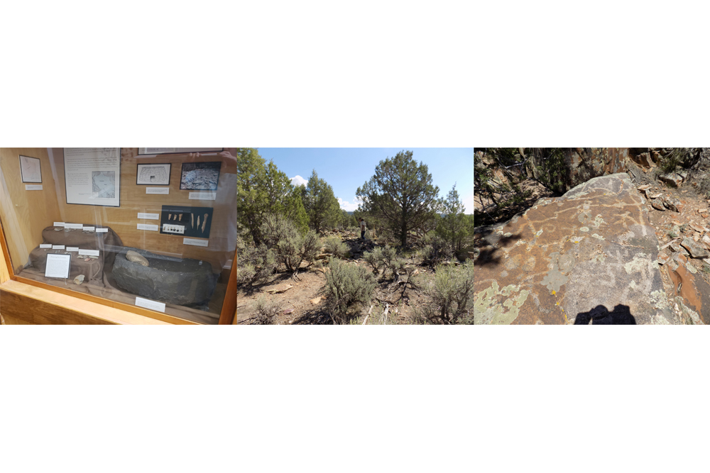
Both reports reference the ruin that Escalante mentions in his journal. Rand Greubel, an archeologist who has written about the site, has written a sidebar with additional information about the ruin. The Rimrocker Museum (rimrocker.org) in Nucla, Colorado has a display case of the artifacts found at the site.
By Glade Hadden: PhD: Archaeologist, BLM (retired)
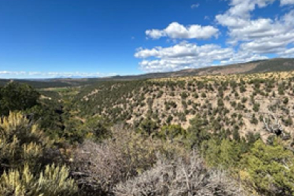
On August 23, the party continued along the north side of the San Miguel River. After four leagues of travel, they began their ascent of La Sierra de los Tabehuachis (Note: The Tabeguache area is named for the Tabeguache band of the Ute People. The area named Sierra de los Tabehuaches by Escalante is today known as the Uncompahgre Plateau after the Uncompahgre Ute People). Following a flowing stream (Cottonwood Creek) which feeds into the San Miguel River not far downstream, the party worked their way into the foothills of the Uncompahgre plateau. Not far up this canyon, the party came out into a broad open valley in which a flowing spring was found. On the top of the hill above the spring, Escalante observed “the ruins of a small and ancient pueblo”.
****After crossing the San Miguel River on county road DD30, turn left (East) on Highway 90. Continue east some 6.4 miles to the San Miguel River bridge. After crossing the bridge, the pavement ends near the original (abandoned) townsite of Pinyon. From this point, Highway 90 is an “all weather” gravel road.
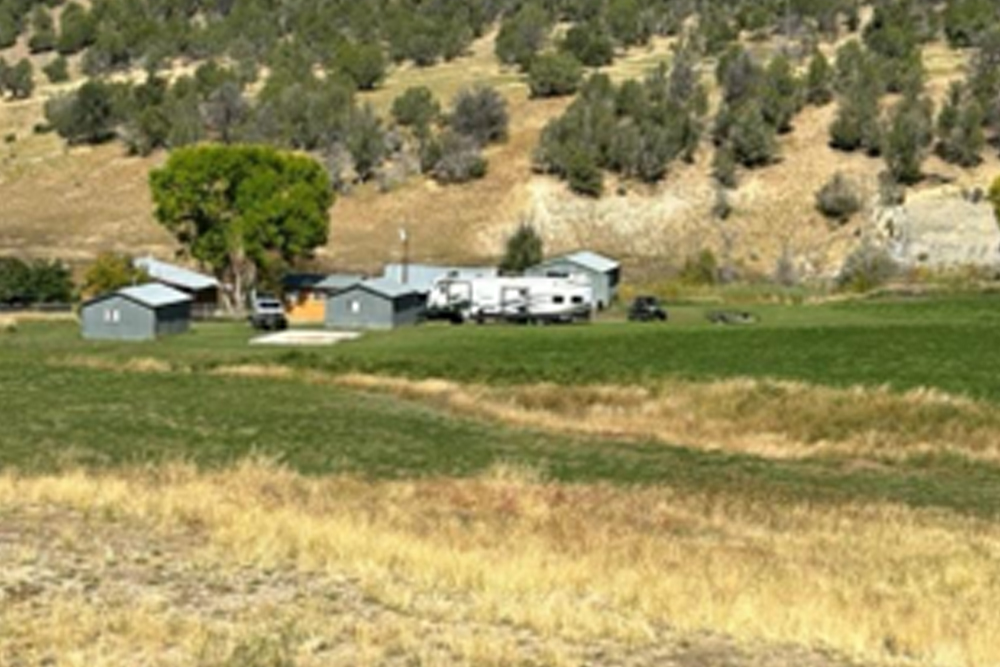
Nine miles from the Highway 90 turnoff you will reach the current Weimer Ranch (Mile Marker 32 on Highway 90). Note that this is private property and permission is required to enter. From the road above the ranch and hayfields, observe closely and you will see the small “pumphouse” which the current ranch uses to cap and protect the flowing spring observed by Escalante. Tumbled stone walls on the cliff top, (the “Small and ancient pueblo) are the last remains of Cottonwood Pueblo, a formative period village of the ancient ones. ****
Continuing uphill, the Domínguez-Escalante party followed a ridge leading toward the high country, until they met a Tabeguache Ute man. The party stopped near Cottonwood Creek (La Fuente de la Guía or “the spring of the guide”) to talk to this man, who agreed to become their guide over the Uncompahgre. After agreeing to guide the party the following day, the Ute man left the group to gather his people.
Driving: After turning northeasterly on Highway 90, drive 6.5 miles to the abandoned townsite of Pinyon. Stop and visit the old “Pioneer Cemetery” on the side of the road. The town of Pinyon was the original settlement of what would become the communal experiment of Nucla.
From Pinyon, continue driving an additional 2.5 miles to the present-day Weimer Ranch. The ancient pueblo noted by Escalante is visible at the top of the hill above the current ranch buildings, all of which are grouped around the spring noted in Escalante’s journal.
By Linda Adkins: DEEEP Team Member
August 23 – Our travelers left El Paraje de San Felipe (Saint Phillip’s Place) on the San Miguel River; climbed Bucktail Creek and descended Telephone Draw, traveling around 5 miles easterly, a twisting trail following the foot of the Uncompahgre Plateau, leaving the San Miguel River. Here they came upon a spring in a “narrow valley with good pasturage” next to a low ridge topped by ruins “a small and ancient pueblo.” At the present time this location is on private property; the ruins (Cottonwood Pueblo) have been excavated by archaeologists several times. They continued 5 miles up the Little Cottonwood Creek drainage, and at the headwater of Cottonwood Creek they met a “Tabaguache Ute”. Stopping to talk, eat and smoke, the company asked about the route ahead, and about the tribes they hoped to encounter. At first the Ute was hesitant to answer, but eventually he agreed to be a guide to the expedition if they would wait for him to return the following day. This campsite was named La Fuente de la Guía (the Source of the Guide).
