August 20
Camp Name
The Waterhole of Saint Bernard
Camp Name (Spanish)
San Bernabé
Brightness of the Moon
32%
Distance Traveled
6 leagues / 15.75 miles
Daylight
13 hours / 31 minutes
Water Resources
Small Unnamed Spring
Journal Description for August 20th
On the 20th we got out of El Cajón del Yeso, backtracking one league to the southeast; we crossed the river again, east-northeast of which about a quarter league away we saw, on some small mounts, outcroppings of very good transparent gypsum. After crossing the river we entered a very wide ravine, and over a well-beaten trail which goes toward the foot of a tall mesa we traveled three leagues to the east-northeast. Then, at the importunities of Don Bernardo Miera, who did not favor following this course, Andrés the interpreter took us over a high rough incline, so rocky that we expected to find ourselves forced to backtrack from halfway up, for the mounts were being so much abused that many of them were marking the spoor on the stones with the blood which these were drawing from their hind and fore feet. We climbed it with the most trying labor and at the end of several northbound hours, after having gone about a quarter league in the ascent, we traveled a mile northwest atop the crest. And from here we saw that the trail went along the base of this mesa and over good and entirely level terrain.
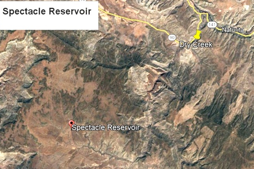
In the descent, which is extensive and without stone, we went north for more than three-quarters of a league. We continued northeast a little more than a league over a sagebrush stretch where there was a lot of small prickly pear cactus,96The nopal is commonly called tunas in the Southwest. The Anglos called this the prickly pear cactus. and to avoid the trouble which this caused the mounts we entered the box channel of an arroyo; then, after going through it for a league to the east, we unexpectedly came upon a plenteous source of good water, consisting of that which banks up when it rains and of some from a tiny spring. This we named San Bernabé.97They were southeast of Spectacle Reservoir, from which they entered the west fork of Dry Creek Canyon and camped on a Ute camping site. They refer to this later as “El Aguaje de San Bernabe,” or a “waterhole.” As the trails and the ruins of huts hereabouts indicate, it is a Yuta camping site, and to it comes the trail we had left on climbing that impassable incline. We halted here even though the pasturage is not very abundant, after having traveled six leagues98About 15¾ miles. today (not counting the backtracking).
Scroll to the bottom to view photos.
Notable Event
This was a frustrating day as there was a lot of back tracking. Their campsite was near ruins of a Ute campsite.Miller Report Summary
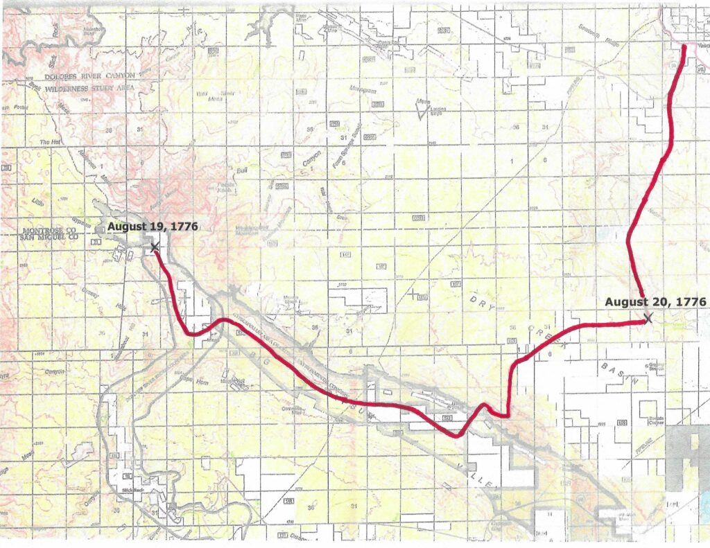
As a result of the decision, August 20 found the expedition backtracking upstream along the Dolores (southward) to the Big Gypsum Valley which they followed for several miles before climbing out to the east into Dry Creek Basin. This they crossed with little difficulty and entered the west fork of Dry Creek Canyon where sufficient water for camp was found just south of the present Montrose-San Miguel County line. DEEEP’s Field Notes
Copyright © 2024, DEEEP Colorado. All Rights Reserved.
August 20, 1776
Mapping by Linda Adkins: DEEEP Team Member
By Carol Hunter: DEEEP Coordinator
August 20, 1776, was a difficult and very frustrating day for Fathers Domínguez and Escalante and most likely for their crew. The journal reads that they left their campsite of August 19th near the Dolores River and after backtracking they were in the Big Gypsum valley following a “well-beaten trail which goes toward the foot of a tall mesa.” Don Bernardo Miera, insisted that they not follow “this course” so Andrés lead them over “a rough incline.” This route was so difficult that many of the horses’ hoofs left blood on the stones. Once they made it to the top, they could see the trail that they had previously been following was going in the same direction they were now headed. The descent was much easier and they were now in Dry Creek Basin. Here they came upon an unexpected source of water which they named San Bernabé (Saint Bernard) and ruins of huts they thought belonged to the Utes.
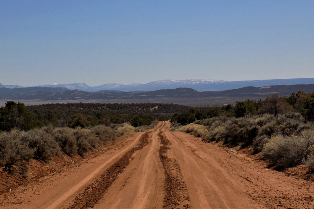
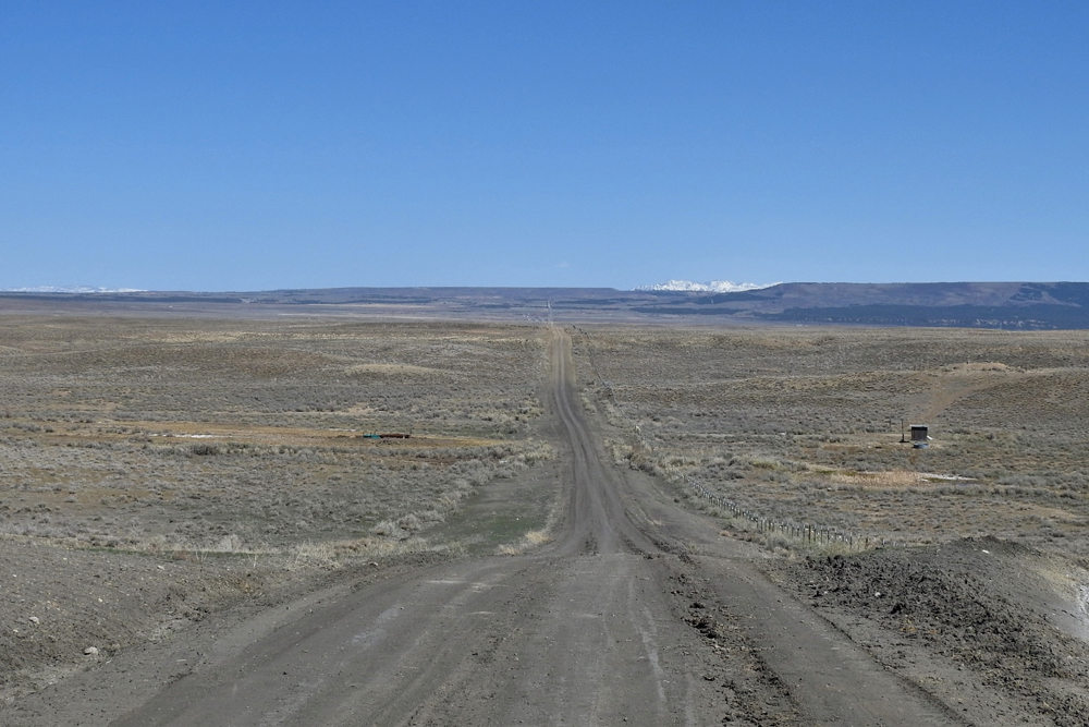
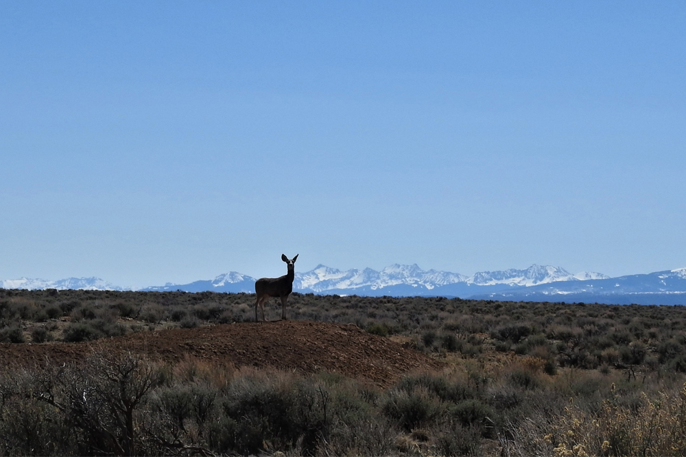
The Domínguez-Escalante Journal entry really does not explain what they are seeing. The landscape is huge with the horizon miles and miles away. Even now there are few structures that can be seen and these are oil and gas related along with some evidence of mining and a small number of corrals. Gypsum pieces can be seen across the land as if thrown about. There are few landmarks. In 1976, when the Miller report was done, the team was not able to find a road that would take them into the basin. That has all changed now because of oil and gas development. There are dirt roads but they are not passable when wet.
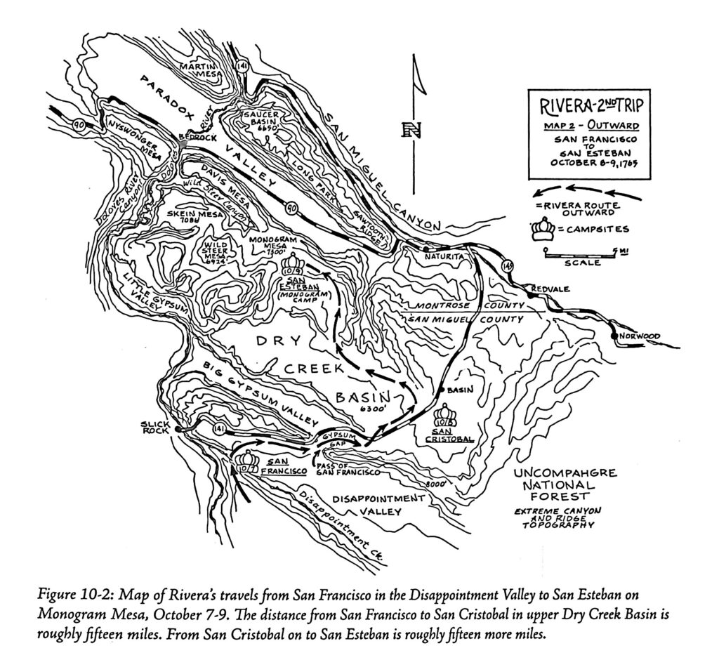
This map is taken from Baker, Steven G. (2015). Juan Rivera’s Colorado, 1765: the first Spaniards among the Ute and Paiute Indians on the trails to Teguayo, the comprehensive illustrated trail study and ethnohistory with the original Rivera journals and English translations. Western Reflections Publishing Company.
This map is used with permission of the author. Juan Rivera traveled through Dry Creek Basin on October 8-9, 1765, nine years before the Domínguez and Escalante Expedition. The purpose of his expedition was to investigate rumors of silver mines. With him were Don Joaquín and Andrés Muñiz who would be interpreters and guides for the Domínguez-Escalante Expedition. It makes you wonder if these two guides recognized having traveled in this basin before. Escalante’s journal entry for August 22nd, refers to Rivera and a landmark they recognized when they were with him.
There are several archeologists on the DEEEP team and they have searched state records for archeological surveys that might show the location of the ruins. No reports have been found.
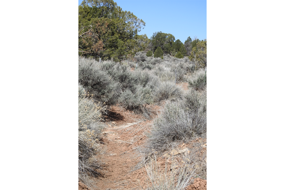
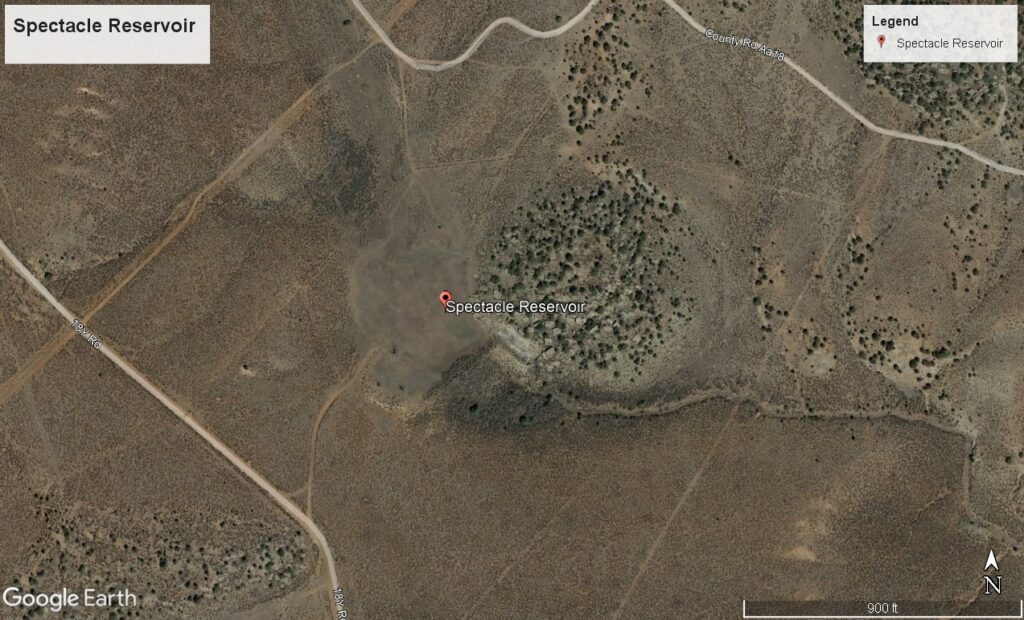
Footnote #97 from The Domínguez-Escalante Journal edited by Dr. Ted Warner reads: “They were southeast of Spectacle Reservoir, from which they entered the west fork of Dry Creek Canyon and camped on a Ute camping site. It took me several tries to locate Spectacle Reservoir. It was empty and made with shallow berms. A journal entry for the same day mentions a number of prickly pear cacti. They are still there in different shades of yellow and pink. A pipeline runs just east of it to the north and disappears over a large hill. A small shed nearby is the only structure you can see for miles in any direction. It’s a very unforgiving place and it seems surprising that they make no comment about it. The journal reads: “we unexpectedly came upon a plenteous source of good water, consisting of that which banks up when it rains and of some from a tiny spring.” It seems likely they were on the west fork of Dry Creek. In this vast emptiness, it would also explain why it was a good campsite for the Utes.
This map was created by Linda Adkins, a DEEEP member and excellent map maker. Linda started where Dry Creek and the San Miguel River meet, which is also very near to the location of the August 21st campsite. (The campsite location is in the upper right-hand corner of this map.) Reading the journal from August 21st to August 19th she was able to take the directions and the distance measurements and backtrack to find the locations of the campsites for August 19th and 20th which shows the Expedition route of travel for the 20th of August. They stated that they traveled 6 leagues or 15 ¾ miles, not including their backtracking, all of which would have been difficult. August in this country could be unbearably hot, having rough terrain, with no shade and little water.
