August 19
Camp Name
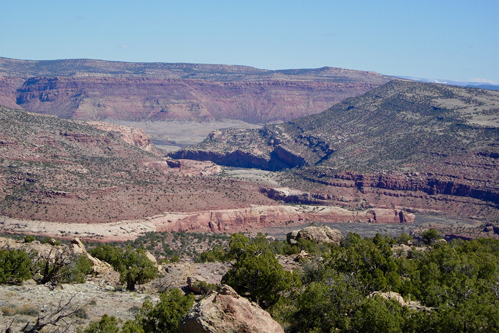
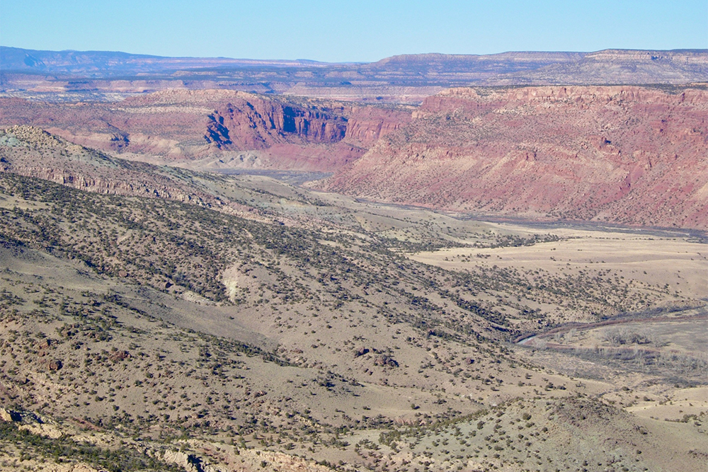
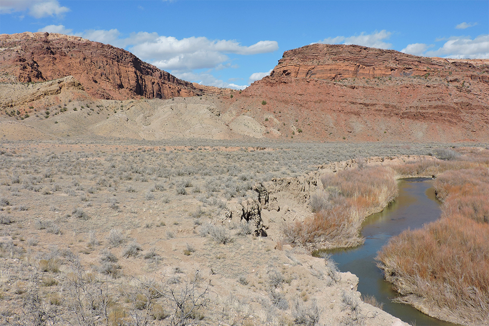
The Gypsum Canyon
Camp Name (Spanish)
El Cajón del Yeso
Brightness of the Moon
23%
Distance Traveled
2 leagues / 5.25 miles
Daylight
13 hours / 32 minutes
Water Resources
Dolores River
Journal Description for August 19th
On the 19th we continued downstream90That is, down the Dolores River. and, after going with no little difficulty one league to the northeast and another northwest, we halted by another bend of the river so that, after the mounts had drunk, we might be able to leave it and follow a path which went northwest, here taking the river northward should the terrain’s roughness allow us to do so. In the meantime, one of the companions went to find out if this path was negotiable up to where one passed the chain of high and rocky mesas over which we intended to cross, since by now the river’s box channel was impassable. It was discovered that the path did not go over passable ground in that northwesterly direction. Another footpath or trail was found going southwest; but even though it was gone over for a long distance during which it presented no obstacle, we did not risk following it because, farther ahead of what had been inspected, high mesas and canyons could be seen where we could again hem ourselves in and find ourselves forced to backtrack.
Over and above this, the great aridness of the surroundings already seen made us believe that whatever rainwater pools and even small springs of running water that might be encountered hereabouts would turn out to be completely dry. We conferred with the companions who had journeyed through this region as to which direction we should take in order to forestall so many difficulties, and each one had a different opinion. Therefore, finding ourselves in this quandary, not knowing if we could follow the path mentioned or if it was better to backtrack a little and take the trail which goes to the Sabuagana Yutas,91The Mowataviwatsiu Utes. we put our trust in God and our will in that of His most holy Majesty; then, after begging the intercession of our thrice-holy patron saints that God might direct us through where it would be more conducive to His most holy service, we cast lots between those two trails and drew that of the Sabuaganas. This one we decided to follow until we reached them.
We took a bearing by the sun’s position at this site, which we named El Cajón del Yeso92Following the Dolores River, they passed Steamboat Hill and Grassy Hill and camped where the Little Gypsum Valley opens on to the Dolores, at the south end of Andy’s Mesa. This camp marked a major change in plans for the expedition because of the casting of lots and the determination to take the trail that would lead them to the Sabuagana Utes in a general east-northeast direction. Apparently casting lots was a favorite decision-making device. On October 11 another lot was cast which affected the entire outcome of the expedition. for there being some [gypsum] at a nearby mesa, and found ourselves at 39° 6′ latitude.93They were perhaps closer to 37° 30′. Their calculations were considerably off at this point. Today two leagues.93About 5¼miles.
Scroll to the bottom to view photos.
Notable Event
After finishing their travel on August 19 — and having explored routes toward the north, northwest and southwest — the expedition members could not agree on which direction to travel the next day and so cast lots for which trail to follow on August 20.Miller Report Summary
The next day’s progress was equally difficult as the company continued downstream two leagues. That night camp was established at a point where Little Gypsum Valley opens on the Dolores. The bed of the river was not passable beyond that point but two trails left the Dolores near the campsite, one by way of Little Gypsum Valley and the other led southwestward into the mountains. A third trail out had earlier been sighted leading to the southeast in what is now Big Gypsum Valley. Boxed in and confused, the padres decided to cast lots, leaving the decision to God. This was done August 19. The Big Gypsum Valley trail was chosen. Expedition leaders expected this route to lead to the land of the Utes and seemed quite happy with the choice.DEEEP’s Field Notes
Copyright © 2024, DEEEP Colorado. All Rights Reserved.
August 19, 1776
By Cole Crocker-Bedford: DEEEP Team Member
Mapping provided by Linda Adkins, DEEEP Team Member, with assistance from Carol Hunter, DEEEP Coordinator
On August 19 they departed their August 18 camp that was at the mouth of McIntyre Canyon and traveled 1 league toward the northeast and then 1 league toward the northwest, where they stopped at a large bend in the river that is south of where the Dolores River enters a narrow canyon that is impassable by horses. Their first league toward the northeast would have kept them near the Dolores River where it passes through the very narrow canyon that is between Steamboat Hill and Cape Horn. After exiting that narrow canyon into the open Big Gypsum Valley, instead of continuing to follow beside the river — and being slowed by the river’s winding and its dense coyote willows and likely many beaver dams — the expedition would have stayed well to the southwest of the Dolores River while traveling in a nearly straight line toward the northwest through grassland and scattered pinyon-juniper woodland. By traveling to the northwest via that overland route they would have arrived after only one hour of travel (= one league) on the west side of the big bend in the river that is two-thirds of a mile southwest of the bridge of County Road 20R, whereas traveling toward the northwest along the river would have entailed 5.7 actual miles and taken 2 or more hours (at least 2 leagues).
From the location on the west side of the big bend in the river, they quickly learned that the river entered a narrow canyon to their north that was impassable for horses. They set up camp on the west side of the big bend while riders explored two potential routes west. One route was toward the northwest through easily traveled Little Gypsum Valley, but upon reaching Sylvie’s Pocket the riders would have seen that further travel in every direction that was even a little westward, was blocked by a deep canyon and tall cliffs. The riders who followed the trail that led southwest from their August 19 camp encountered no obstacle contrary to horse travel, but the expedition’s members had grave concerns about lack of water: the rocky pools that temporarily hold rainwater had little or no water. The expedition cast lots on whether to follow the trail to the southwest on August 20, or to take a known trail to the east and northeast to the Sabuagana Utes. The known trail was chosen. On the 20th of August they backtracked one league toward the southeast, where they crossed the Dolores River and picked up the trail toward the Sabuagana Utes.
They named their campsite of August 19, 1776, El Cajón del Yeso after the nearby gypsum hills (gypsum hills line the northeastern side of Gypsum Valley). They also took a latitude reading at the August 19 campsite, which was the third latitude reading of the Expedition. The Domínguez-Escalante journal stated the latitude there to be 39° 6’. Warner and Chavez in their footnote 93 stated the actual latitude was “perhaps closer to 37° 30’.” The actual latitude on modern maps is 38 degrees, 9 minutes, north.
