August 18
Camp Name
N/A
Camp Name (Spanish)
N/A
Brightness of the Moon
16%
Distance Traveled
1 league / 2.63 miles
Daylight
13 hours / 33 minutes
Water Resources
Dolores River
Journal Description for August 18th
On the 18th two of the companions set out early to study a way by which we could get out of the river’s box channel, which here has tall and very rocky mesas on either side, so as not to get too far away from it for as long as it did not change direction, which is north here, nor stray too far off for lack of water and pasturage. No way was found by which to get out without going through the river’s box channel, in which, because of so much rock and the necessity of having to cross it many times, we feared that our mounts would wear out their hooves. Leaving El Ancón de San Bernardo, we went one league downstream toward the north and halted88From the mouth of Summit Canyon they proceeded almost due north along the Dolores River and camped at the mouth of McIntyre Canyon. so that they could go on to survey more than what they had traveled during the morning. They returned about eight in the morning, saying that only through the river’s box channel could we get out, although with difficulty, from this impassable mass of mesas. And so we decided to proceed through the river’s box channel. Today one league89That is, 2.63 miles. north.
Scroll to the bottom to view photos.
Notable Event
Scouts tried to find a way out of the box canyon through which the Dolores River flowed. They did not find any way out, so the expedition proceeded down the bottom of the canyon despite a concern that the horses would be in water so much that their hooves would soften and be damaged on rocks.Miller Report Summary
There seemed only one course open—down the bed of the stream, northward. However, the going was difficult and slow and the evening of August 18 found them only one league from the previous campsite.DEEEP’s Field Notes
Copyright © 2024, DEEEP Colorado. All Rights Reserved.
August 18, 1776
By Cole Crocker-Bedford: DEEEP Team Member
On August 18, 1776, scouts spent much of the day trying to find a way “out of the [Dolores] river’s box channel [canyon], which here has tall and very rocky mesas on either side, so as not to get too far away from it …[so as to stay close] for water and pasturage.” Domínguez and Escalante hoped to avoid traveling down the bottom of the Dolores River canyon where they would need to cross the river many times, “because of so much rock and the necessity of having to cross [the river] many times, we feared that our mounts would wear out their hooves” (Chavez and Warner translation). When in water for too much time, horses hooves soften and weaken, and repeated wet-dry cycles lead to cracks and sloughing (https://www.theequinedocumentalist.com/post/wet-dry-cycles-effect-on-the-hoof).
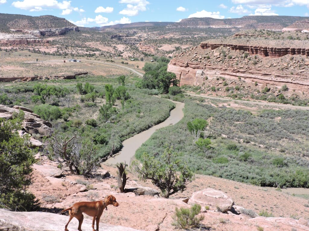
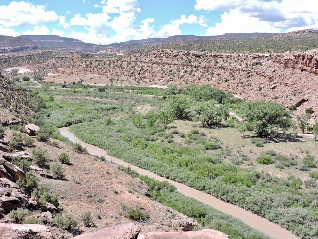
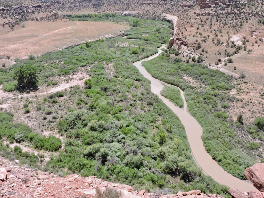
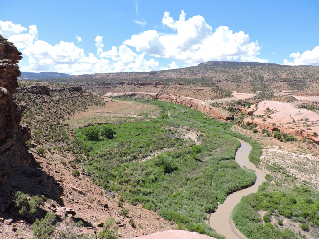
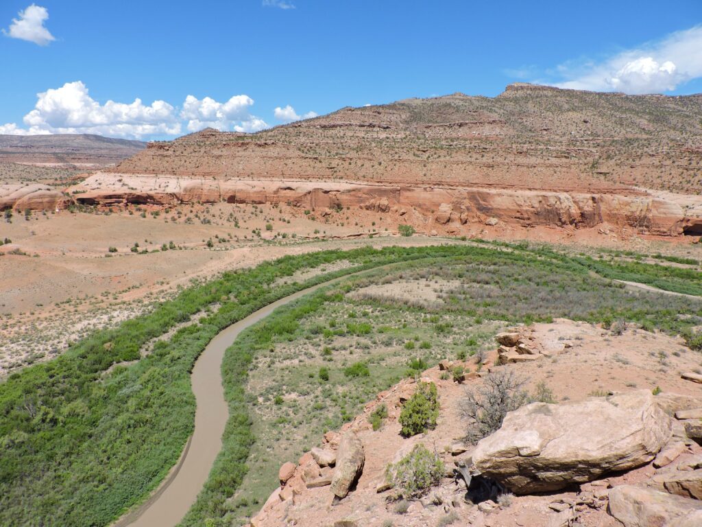
I have trouble believing that Domínguez and Escalante would have needed to be concerned about their horses hooves when traveling the canyon bottom and needing to cross the Dolores River at intervals that range from 1/4 mile to 3/4 mile, if the conditions were the same as today. My wife and I own most of the inner canyon (Escalante’s box channel) between the camp of August 17 and their camp of August 18, 1776. Cowboys on horses and cows often pass through our bottomland, and their brief time actually in the river is far too little to significantly soften the hooves of the horses and cows. Even without shoes, horses hooves would not suffer during their brief time today on the rounded, smooth river gravel. So what was different 250 years ago than the current day photos that I post at the end of this essay?
I have over 50 years of natural resource experience, in both management and research (my last salaried position was Chief of Natural Resources and All Research for Grand Canyon National Park, and I have observed my Dolores River property and nearby areas since 1995). Without going into technical details, I will just say that it is my belief that the Dolores River floodplain between Summit Canyon and McIntyre Canyon was formed in part by innumerable beaver dams that stretched across the floodplain to both sides of the box canyon. The beavers would have had lots of large wood from the mountains and cottonwood galleries with which to construct dams in the river’s main channel that could withstand and spread the high flows of spring. The forested mountains likely provided well over 90% of the large wood into the Dolores River, but that wood is now entirely stopped by McPhee Dam and its reservoir. And some cottonwood galleries were cleared for farmland. Today when beavers build a dam within the Dolores River at Slick Rock, it is comprised of the thin stems and branches of coyote willows and is quickly washed out by the first high flow. However, I’ve seen other rivers that have greater spring flows than the Dolores River (even before McPhee Dam), where beaver dams constructed with large trees in the main channel withstand spring flows. And where the rivers are spread wide across their floodplains by many hundreds of beaver dams, often constructed with somewhat smaller wood that can withstand the slower moving water outside the main river channel. At any one location it takes many beaver dams and small ponds to stretch across the valley bottom, and the dams and ponds are continuous up and down the river, so that the valley bottom becomes an immense spread of small ponds outside the main river channel. In short, I suspect — but cannot prove — that in 1776 what is now dry floodplain in August was a maze of small beaver ponds, which would explain why Domínguez and Escalante were so concerned about their horses hooves. If I am correct, then the Domínguez-Escalante Expedition could not have followed the bottom of the box canyon without being in water most of the time, whereas now the floodplain is dry in August.
At the end of this essay are five modern photos by myself of the box canyon traveled by Domínguez and Escalante on August 18, 1776. The mileage in each caption is the river miles below the mouth of Summit Creek, which is the location of one of the two potential sites for the camp of August 17, 1776. I took the photos on August 18, 2022, a year with just a little less than average rainfall. The last of the five photos (river mile 3.3 to 3.7 below Summit Creek) includes the general area of McIntyre Canyon’s mouth, where Domínguez and Escalante camped on August 18, 1776 (per Chavez and Warner), but I have no idea where in the photo they actually camped. Moreover, in 1776 the river likely had a different shape (the river’s shape there even changed between the 1960 and 1994 USGS topography maps).
Most of the potential Domínguez-Escalante camps of August 18, 1776, are on BLM Public Land. However, there is no public road to the area (only a private two-track used only for gas pipeline maintenance), and all hiking routes require permission to pass through private property (unless a person scales cliffs to stay on public land). Even so, during years when the Dolores River below McPhee Dam flows enough to support boating, the area is accessible by oar boat or kayak.

