August 17
Camp Name
The Bend of San Bernardo
Camp Name (Spanish)
San Bernardo or El Ancón de San Bernardo
Brightness of the Moon
9%
Distance Traveled
7 leagues / 18 miles
Daylight
13 hours / 35 minutes
Water Resources
La Agua Escondida, bottom of El Laberinto Canyon, Dolores River
Journal Description for August 17th
On the 17th we set out from La Agua Escondida, and about half past three in the afternoon we arrived a third time at El Río de Dolores, having traveled along the entire canyon79Summit Canyon. and its many turns for seven leagues to the north, which in a straight line must be four or five at the most. The canyon we named El Laberinto de Miera80“Miera’s Labyrinth.” Named after Don Bernardo Miera y Pacheco, the retired military captain who accompanied the expedition as cartographer. because of the varied and pleasing scenery of rock cliffs which it has on either side and which, for being so lofty and craggy at the turns, makes the exit seem all the more difficult the farther one advances — and because Don Bernardo Miera was the first one to go through it. It is negotiable all the way and not too troublesome for the horse herds, except one passage which can be easily improved.
On reaching the river we saw quite recent tracks of Yutas,81The Spaniards referred to the present-day Ute Indians as the Yutas. from which we figured there was an encampment of theirs nearby. And, weighing the fact that if they had seen us and we did not make advances toward them they might suspect some mischief on our part, the fear of which would alarm them, and that one of them might be able to guide us or furnish us with some hints for continuing our journey with less difficulty and hardship than the one we were now experiencing — for none of our companions knew the water sources and terrain ahead — we decided to seek them out.82Apparently not trusting their guides at this point, they tried to locate the known trail themselves, which eventually they did.
As soon as we halted by a bend of the river, which we named San Bernardo,83This campsite is on the Dolores River in Summit Canyon. Disappointment Valley opens up immediately east of the campsite. At the present time there is considerable mining activity opposite Summit Canyon. Padre Fray Francisco set forth, accompanied by Andrés Muñiz the interpreter and Don Juan Pedro Cisneros, following the tracks upstream for about three leagues. They ascertained that they were Tabehuachi Yutas84The Taviwatsiu. but could not find them, after having gone as far as the point where the little Río de las Paralíticas85Paralysis River—so named, they said, because of the three Indian women seen on its banks who were suffering some form of paralysis. They were probably on present-day Disappointment Creek. (so named because the first of our own to see it found in an encampment by its edge three female Yutas with the infirmity of this name) separates the Tabehuachi Yutas from the Muhuachi86Today the Mowatei Indians of the Ute. ones, the latter living to the south and the others to the north. Today seven leagues, which in a straight line would be four to the north.
Footnote Discussion: Today, because of the many twists and turns, they calculated that they traveled over 18 miles, but which, if they had gone in a straight line, would have been only 10.5 miles
Scroll to the bottom to view photos.
Notable Event
D-E named the canyon that they traveled, El Laberinto de Miera (Miera’s Labyrinth) “because of the varied and pleasing scenery of rock cliffs which it has on either side and” … “being so lofty and craggy”. From the day that they departed Sante Fe on July 29, 1776, until the expedition entered what is now Utah on September 12, 1776, the canyon El Laberinto de Miera was the only area for which the scenery impressed Escalante so much that he actually mentioned scenery in his journal of the expedition.Miller Report Summary
The following day the expedition continued down rugged Summit Canyon to the Dolores River for the third time. After camping on the west bank of the river the night of August 17, the padres were at a loss to know how to proceed.DEEEP’s Field Notes
Copyright © 2024, DEEEP Colorado. All Rights Reserved.
August 17, 1776
By Cole Crocker-Bedford: DEEEP Team Member
August 17, 1776: El Laberinto de Miera (Miera’s Labyrinth),
The San Bernardo Campsite on the Dolores River, and The Little Río de las Paralíticas
The Canyon El Laberinto de Miera. On August 17, 1776, the Domínguez-Escalante Expedition departed their camp at La Agua Escondida, and rode down the bottom of the canyon that they called El Laberinto de Miera to camp near the Dolores River. Footnote 79 of Chavez and Warner states that Domínguez and Escalante rode down Summit Canyon to its mouth; however, Chavez and Warner never stated how the expedition entered Summit Canyon. Moreover, the Miller’s Research Team (see Webpage for Aug 16, 1776) did not have time to search for Domínguez and Escalante’s entrance into Summit Canyon. After extensive analyses of topography maps, I spent more than a dozen days hiking to explore options for entering the bottom of modern-day Summit Canyon via horse. I found a few options where horses could enter the bottom of Summit Canyon from what is now Utah; however, the Domínguez-Escalante journal states in its first paragraph for August 17 that they “traveled along the entire canyon and its many turns for seven leagues to the north (Escalante’s words “al norte”), which in a straight line must have been four or five at most.” Also, the last sentence for August 17 read: “Today seven leagues, which in a straight line would be four leagues to the north.” (“al norte”) All of the horse capable routes into Summit Canyon from Utah would involve traveling to the northeast from the camp of August 16 to the camp of August 17, not to the north as stated twice by the Domínguez-Escalante journal. There is only one horse-capable route into the bottom of Summit Canyon that would involve predominately northerly travel from the La Agua Escondida camp to the Dolores River at the mouth of Summit Canyon, and that is down the canyon that is now called Bishop Canyon. I firmly believe that Bishop Canyon is the upper (southern) six miles of the canyon that Domínguez and Escalante called El Laberinto de Miera. The rest of El Laberinto de Miera is the inner canyon of modern Summit Canyon downstream from its confluence with Bishop Canyon. Modern Bishop Canyon is similar in size to modern Summit Canyon above its confluence with Bishop Canyon, and Bishop Canyon may actually carry a little more water than does modern Summit Canyon upstream from its confluence with Bishop Canyon. In other words, modern Bishop Canyon and modern Summit Canyon below its confluence with Bishop Canyon could just as well be called by one name (perhaps El Laberinto de Miera) while Summit Canyon could be applied to only the canyon that is upstream from the confluence with El Laberinto de Miera.
Another reason for my firm belief that the canyon El Laberinto de Miera begins at the southern (top) end of modern Bishop Canyon, is that the August 16 description of the top mouth of the canyon, the shape of the canyon, the direction of the upper canyon, and the location of La Agua Escondida, all fit the upper end of Bishop Canyon way better than those same traits for any other horse capable route to the bottom of Summit Canyon. Of the Utah entrances into Summit Canyon, the one that somewhat fits Domínguez and Escalante’s description of the entrance canyon is Secret Canyon, which is found 5 miles west of Bishop Canyon.
Domínguez and Escalante named the canyon that they traveled on August 17, 1776, El Laberinto de Miera (Miera’s Labyrinth) “because of the varied and pleasing scenery of rock cliffs which it has on either side and which, for being so lofty and craggy at the turns, makes the exit seem all the more difficult the farther that one advances — and because Don Bernardo Miera was the first to go through it.” I found that sentence (per the Chavez and Warner translation) of particular interest, because from the day that they departed Sante Fe on July 29, 1776, until the expedition entered what is now Utah on September 12, 1776, the canyon El Laberinto de Miera was the only area for which the scenery impressed Escalante so much that he actually mentioned scenery in his journal of the expedition.
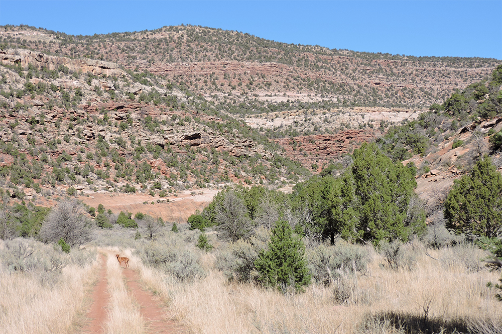
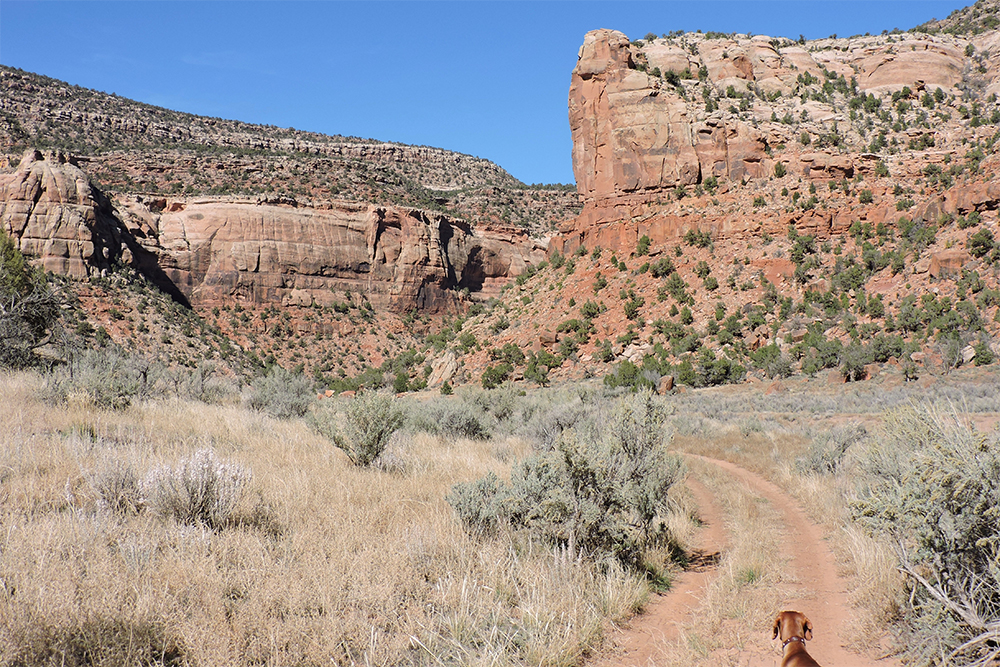
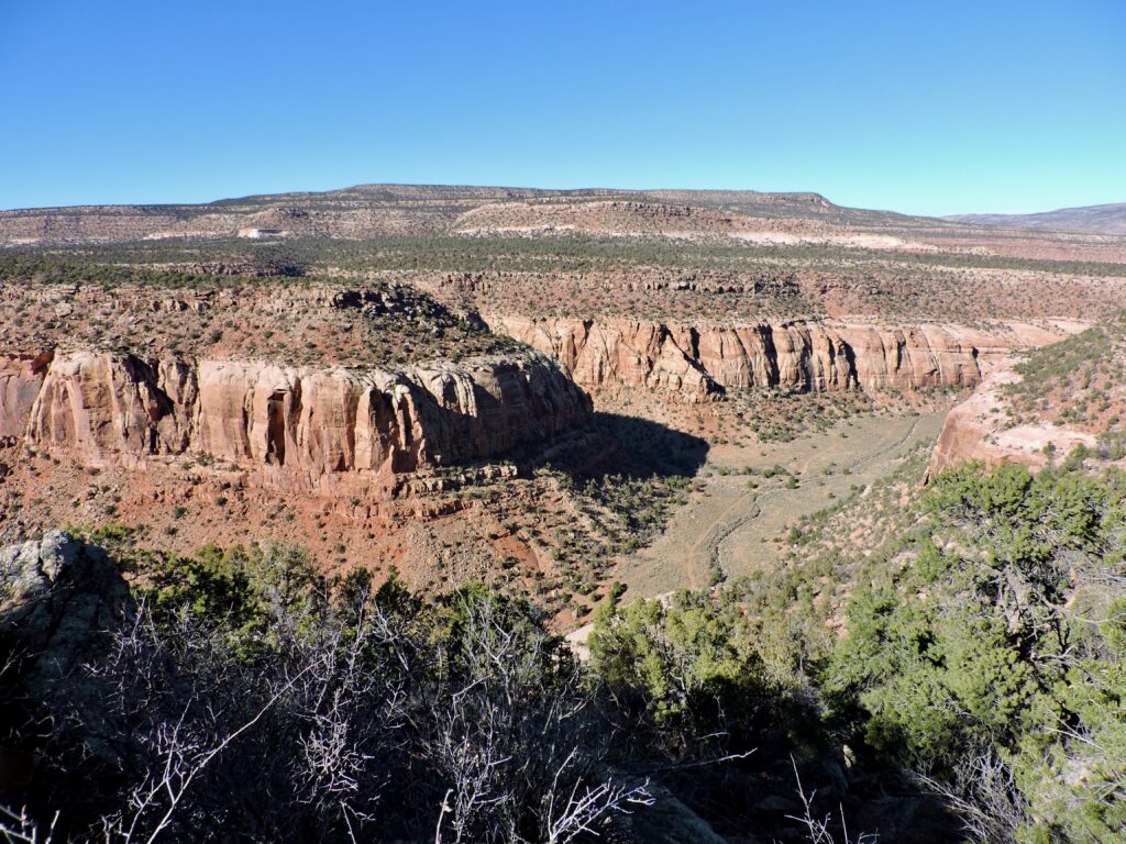
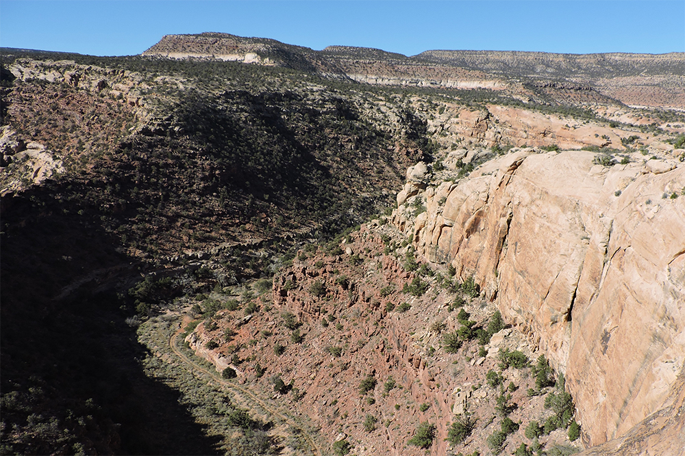
Because the scenery of El Laberinto de Miera Canyon so impressed the Domínguez-Escalante Expedition, I took photographs at 1.0-mile intervals when I walked down the canyon for ten miles below their campsite of August 16, 1776. My intervals of 1.0-mile were determined by my GPS unit. I needed to walk back to my vehicle the same day, so I photographed the lower five miles of the canyon from its rims on other days, estimating the 1.0-mile intervals of the canyon bottom from a topography map. I photographed at 1.0-mile intervals as a method to sample the scenery of El Laberinto Canyon, so my photographs often missed the most spectacular views. Owing to space limitation in this website, only 4 of the photos are included.
Walking with my GPS unit down the canyon bottom for 10 miles, and then using a topography map to estimate the length of the canyon bottom after that, gave 14.8 miles from the camp of August 16, 1776, to the Dolores River. Escalante’s Journal stated that the expedition traveled 7 leagues to reach the Dolores River, which Chavez and Warner estimated to be 18 miles.
The Campsite San Bernardo. Escalante’s journal stated that on August 17, 1776, they made camp “by a bend in the river” after they reached the Dolores River. There are a lot of bends in the Dolores River, but the river bend where the usually dry creek of El Laberinto Canyon (now Summit Canyon Creek) enters the Dolores River is about 135 degrees. In the 1976 edition of The Dominguez-Escalante Journal, by Chavez and Warner, footnote 83 states: “This campsite is on the Dolores River in Summit Canyon.” That is a fairly large area. I narrowed the suspected campsite location to latitude 38 degrees, 2’, 56.09” North, longitude 108 degrees, 54’, 44.56” West, by assuming that the expedition would not have camped really close to the river because there would have been a dense thicket of coyote willow near the river, while given the hot August sun Domínguez and Escalante would have wanted to camp under the shade of cottonwoods. Much of the area beyond the dense willow thicket would have been open grassland. Today only one location provides shading by large cottonwoods at the mouth of Summit Canyon, while not being within the dense thicket of coyote willows immediately adjacent to the Dolores River.
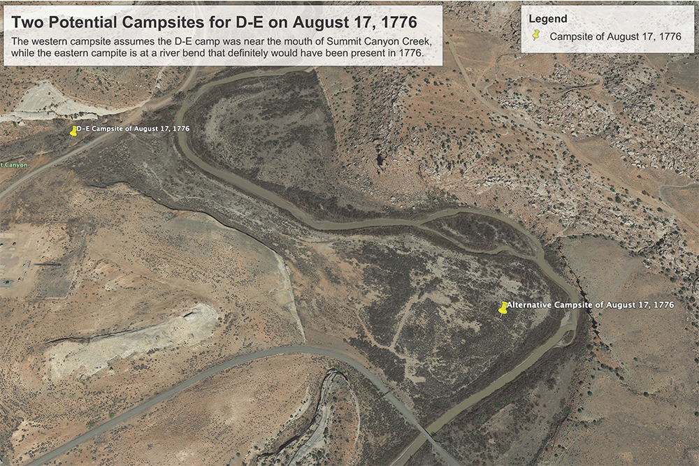
I am not convinced that the August 17, 1776, campsite described in the previous paragraph is the true location of the campsite. The Chavez and Warner translation reads “As soon as we halted by a bend in the river, which we named San Bernardo” at which point footnote 83 reads: “This campsite is on the Dolores River in Summit Canyon.” It is Chavez and Warner’s footnote that induced me to place the campsite where I did for the reasons stated in my previous paragraph. However, I see nothing in the actual journal that states “in Summit Canyon.” Only 0.3 mile ESE of the campsite that I determined one paragraph above, is a bend in the river that is another 135 degree bend. This latter bend would have been in place in 1776 because it is controlled there by sheer cliff, while the river bend at the mouth of Summit Creek might not have been there in 1776 because it is entirely in floodplain and only approaches a cliff in one short location. Perhaps Chavez and Warner had access to a map of the Domínguez-Escalante Expedition that showed the August 17 camp at the mouth of Summit Canyon, but if they did not have such a map then I believe that the location 0.3 mile ESE from the mouth of Summit Canyon Creek is just as likely, if not more likely, to have been the location of Domínguez and Escalante’s actual campsite because the river bend there definitely would have been present 2 centuries ago due to the cliff control of the river’s shape. A more important reason that I suspect that the campsite might actually have been the eastern one, is that the clause “As soon as we halted [to make camp] by a bend in the river” occurs two paragraphs after the paragraph where the journal states that they arrived at the Dolores River, which to me implies that they traveled a little beyond the mouth of Summit Creek before stopping to camp. The location of the eastern campsite, which I believe is the more likely camp, is 38 degrees, 2’, 44” North, 108 degrees, 54’ 17” West.
Both of the potential campsites of August 17, 1776, are now on private land. The western one can be closely viewed from San Miguel County Road Q1, which likely covers part of the potential campsite. The eastern potential campsite can be viewed from County Road S8 where S8 lies 200 yards to the southwest of the potential campsite. See my Google Earth photo of the two potential campsites. The vegetation and soil height of the eastern potential campsite has been altered in major ways during modern times, first as an area where tailings from a uranium mill were placed, and later where the mill tailings and also several feet of the original soil were removed during the uranium mill cleanup conducted in 1996.
Río de las Paralíticas. The Domínguez-Escalante journal states that after reaching the August 17 campsite, that three members of the expedition followed very recent tracks of Yutas up the Dolores River for three leagues to the mouth of the little Río de las Paralíticas, where traders had previously found three female Yutas with the infirmity of this name in a small settlement. Footnote 85 of Chavez and Warner states that this was probably the mouth of present-day Disappointment Creek. I doubt that Chavez or Warner — or any of the other writers quoted below on this webpage who asserted that Río de las Paralíticas is the same as Disappointment Creek — ever actually visited the mouth of Disappointment Creek, because if they had they would have found a deeply incised river channel (ten foot sheer walls that I dared not climb down and could not climb up) and a horrible location for sick women (or anyone) to camp or have a rancheria. In contrast 0.7 air-mile and 1.6 river-miles downriver from the mouth of Disappointment Creek is the mouth of Nicholas Wash. The mouth of Nicholas Wash is an excellent location for a camp or rancheria, and in fact still has the remains of a rock cabin from the time of Euro-American settlement. Moreover, there is an easy shallow trail from Disappointment Valley along Nicholas Wash to the mouth of Nicholas Creek, where there is a natural bedrock ford with gentle banks across the Dolores River. Alternatively, the three men of the Domínguez-Escalante Expedition really did reach the mouth of what we call Disappointment Creek, and that location has changed radically since 1776.
The mouth of Nicholas Wash at the Dolores River is also more easily within range of three leagues each way (six hours total) of travel by the three members of the expedition pushing through dense riparian brush and many times climbing down and up steep and overhanging riverbanks on their horses: 6.4 river-miles instead of 8.0 river-miles to Disappointment Creek. They rode to Río de las Paralíticas and back after they arrived at 3:30 pm at their San Bernardo Camp on the Dolores River. Domínguez and Escalante would have been using natural time or sun time which is similar to what we call standard time. Standard time sunset at Slick Rock on August 17 is a few minutes after 7 pm, and twilight is just after 7:30 pm standard time. So if the three members who rode to Río de las Paralíticas rode for six hours after arriving at the San Bernardo Campsite at 3:30 pm, then they did not return to camp until 2 hours after dark.
