September 9
Camp Name
No Name
Daylight
12 hours / 47 minutes
Brightness of the Moon
10%
Distance Traveled
10 leagues / 26 miles
Weather
No notable weather reported
Water Resources
San Clemente (the White River)
Journal Description for September 9th
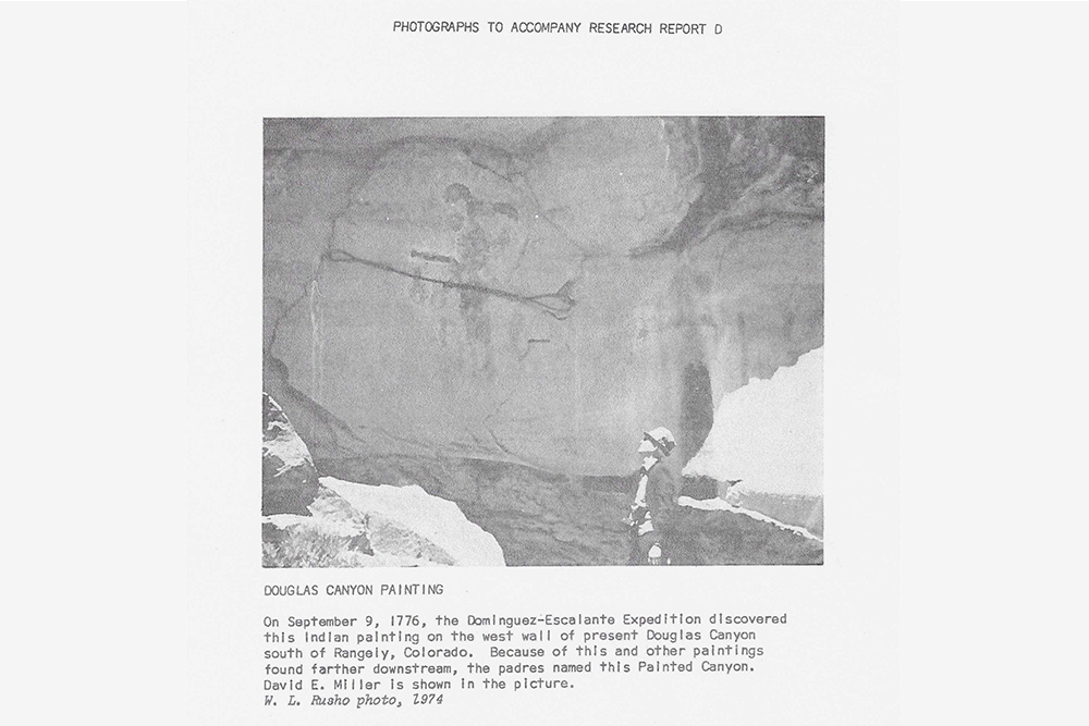
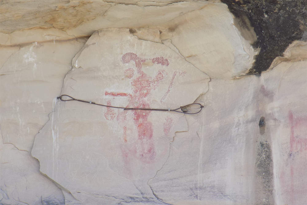
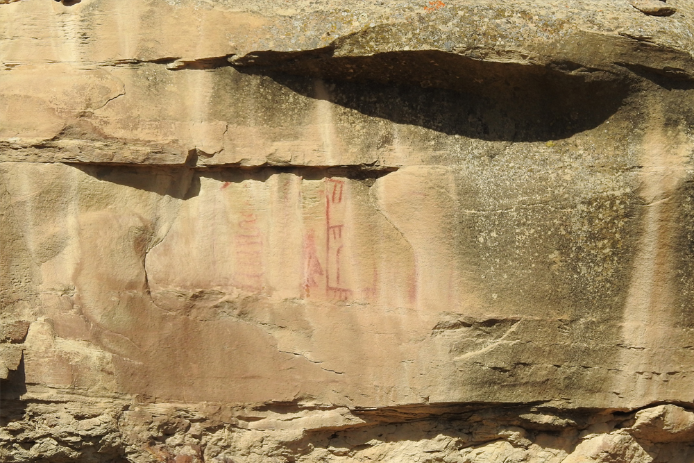
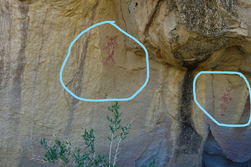
On the 9th we left El Paraje de Santa Delfina along the same canyon, and having gone half a league northwest we swung north-northwest; then, after having trekked nine leagues in this direction all through the canyon over a well-beaten path— and with only one bad stretch, which can be avoided by crossing the steam a little ahead, and going across a thicket of high sagebrush and willows of the kind they call latilla178Genus Helianthemum. –we got out of it. Halfway in this canyon toward the south there is a quite lofty rock cliff on which we saw, crudely painted, three shields, or “Apache shields,” of hide, and a spear head. Farther down on the north side we saw another painting which supposedly represented two men in combat. For this reason we named it El Cañón Pintado,179“Painted Canyon”, so called because of the Indian pictographs they saw. These pictographs are still there located in Douglas Canyon south of Rangely, Colorado, and about half a mile above Philadelphia Creek and Big Bull Draw. and it is only through it that one can go from the ridge mentioned to the nearest river, for the rest of the terrain in between is very broken and rocky.
On this same side of the canyon, already near its exit, there is an exposed vein of metallic ore, but we were ignorant of its nature or quality, although one companion took one of the rocks fallen off the vein, and Don Bernardo Miera, showing it to us, said it was of the sort which miners call tepustete180Perhaps iron pyrite, or “fool’s gold.” and that it is an indication of gold ore. We neither decided nor shall we vouch for this, for not having mining expertise and because a more thorough testing is always required than what we could do at the time. Having passed the canyon, we traveled half a league north-northwest and came to a river which we named San Clemente;181The White River. Camp was located at the confluence of Douglas Creek and the White River at present Rangely, Colorado. we crossed it and halted on its northern edge, where there is a middle-sized meadow of good pasturage. This river is middling and flows west through here, and the terrain adjacent to it offers no prospects for a settlement. Today ten leagues.182Just over 26 miles.
Scroll to the bottom to view photos.
Notable Event
Both the Journal and the Miller report make reference to the rock art found at this day’s location. It is within this day’s location that a very faint rock art signature of D & E dated 1776 is found. The location will not be shared for its protection.Miller Report Summary
The following day’s march was a long one of some 25 miles. By nightfall the padres had threaded Douglas Creek all the way to its confluence with White River at the site of present Rangely. Camp was set up on the north river bank with good pasturage and plenty of water. During the day the company had passed, and Escalante had made note of, two sets of Indian paintings. As a result he named present Douglas Creek, Canon Pintada— Painted Canyon.DEEEP’s Field Notes
Copyright © 2024, DEEEP Colorado. All Rights Reserved.
September 9, 1776
By The Canyon Pintado Team: Daniel Fiscus, Vice President, Rangely Outdoor Museum; and an anonymous professional government advisor
Domínguez and Escalante left “El Paraje Santa Delfina” somewhere on the present-day Brady Ranch. This is the most likely location as there would have been good pasturage for their horses. East Douglas Creek widens here, and today the fields are the only irrigated pastures in the canyon.
The padres continued down East Douglas Creek, most likely along the north side, to the mouth of the canyon near its confluence with the main Douglas Creek drainage. They then traveled northwards along the east side of Douglas Creek (named after Ute Chief Douglas a century later). Halfway through this canyon, the journal describes a prominent outcropping of rocks on which they saw a pictograph with “…three crudely painted shields of hide and the head of a lance.” This panel is weathered but still exists today, located at the East Four Mile interpretive site managed by the Bureau of Land Management (BLM). The multitude of observed Native American rock art ultimately led the Padres to name this area Canyon Pintado, Spanish for ‘Painted Canyon,’ in addition to adding one inscription of their own that reads Año DE 1776.
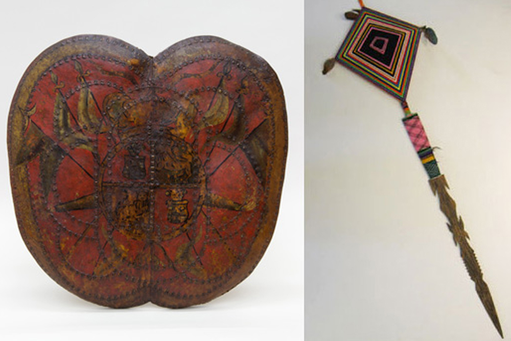
The rock art at East Four Mile depicts three square or rectangle shaped shields and an arrow point. They may not represent shields at all, but rather ‘Medicine Bundles’ due to the size of them in proportion to the spear head. This rock art fits perfect with Chavez’s translation of the Spanish accounts. Chavez described the shields as being Apache shields. Apache shields were traditionally round shaped; however, the text that Chavez used for his translation calls the shields Adargas or Chimales.
The Adarga was a hide shield first introduced to the Spanish in the 15th century by the invading Moors. It was a self-healing shield of hide, that was very light weight. These hide shields fell out of use with the advent of firearms. In the 1700s, however, the Spanish resurrected this ancient shield in their struggle against the Apache, whose guerrilla tactics with bow and arrow were decimating the Spanish. There is a fine example of one of these shields at the ‘Patrimonia Nacional’ museum in Madrid, that was made in “New Spain” in the 1700s.
The Chimalli is a small, square, ceremonial shield, and derives its origins from the Aztec culture, who are distant relatives of the Ute, Shoshone, Paiute, and Hopi Tribes.
The Party continued along Douglas Creek, along a path that is currently Highway 139. They are believed to have crossed Douglas Creek just north of East Four Mile, where the highway does today. The veins of metal can be found today at the north end of Canyon Pintado. It is a low-grade iron ore found on the hills just south of Rangely. At this location it is only found on the west side of Douglas Creek, which also matches the description in the Journal. They also described another rock art panel on that side of the Canyon, with two figures in combat. This panel’s location has not been confirmed and has perhaps since eroded away.
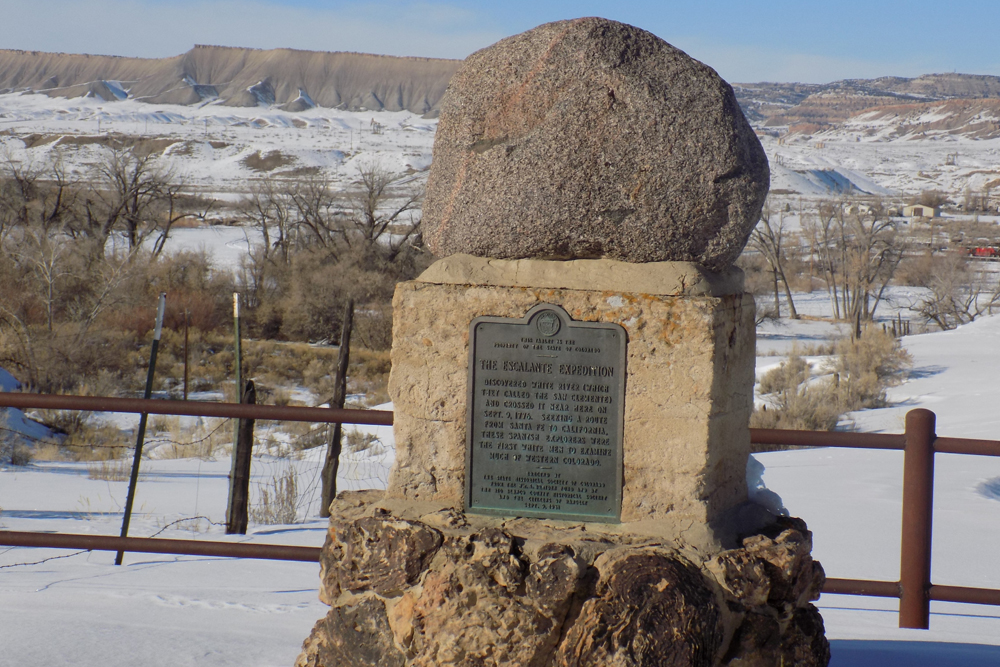
The expedition continued north to Río San Clemente, the name the Padres gave for what was later called the White River. The Utes called this the Smoking River, and it is believed that the name for White River originates from this original Ute name.
