August 12
Camp Name
Our Lady of Sorrows River camp
Camp Name (Spanish)
El Río de Nuestra Señora de Dolores
Brightness of the Moon
3%
Distance Traveled
8.5 leagues / 22 miles
Daylight
13 hours / 45 minutes
Water Resources
Dolores River
Journal Description for August 12th
On the 12th Padre Fray Francisco Atanasio awoke somewhat improved, and more to change terrain and weather than to gain a day’s march, we set out from the site and Río de San Lázaro toward the northwest. We traveled [crossed out: a little more than a league, turned west by west-northwest] five leagues through leafy tree¬growth with good pasturage, took to the west, went two leagues and a half through a sagebruch stretch of little pasturage, and, after a quarter league of travel toward the north, crossed El Río de Nuestra Señora de Dolores67“Our Lady of Sorrows.” Today called simply the Dolores River. The campsite was located very near the present-day site of Dolores, Colorado. It was probably right at the point where the Dolores River turns to the north. and halted on its northern edge. This river rises from La Sierra de la Plata’s northern flank, runs southwest to this place, and from here makes a turn. It is a bit smaller than El Río del Norte around this time of year. Today a little more than eight leagues and a half.68Over 22 miles. The travel was easy going over mostly flat terrain, and it is easy to see why they could cover that distance on that day..
Scroll to the bottom to view photos.
Notable Event
Crossed the Dolores River and camped in river bottom.D&E and Crew Activity
The Journal mentions that Father Domínguez was “somewhat better” and they set out from this site.
Miller Report Summary
August 12 found the ailing father considerably improved and the journey was resumed. Continuing in a northwesterly direction the company crossed from the Mancos drainage into that of the Dolores. Travel was relatively easy most of the way to the Dolores River where the party arrived near the site of present Dolores. Easy access to the river was found by way of Lost Canyon; camp was pitched on the east bank of the stream. Two days were spent here, allowing expedition personnel to visit and examine an ancient pueblo located on the west bluff opposite their campsite.DEEEP’s Field Notes
Copyright © 2024, DEEEP Colorado. All Rights Reserved.
August 12, 1776
By Tom West: DEEEP Team Member
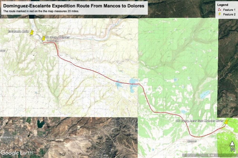
The starting point for today’s journey of the Domínguez-Escalante expedition is at a level area suitable for camping and grazing the animals near the East Mancos River.
You can see the location of the starting point in today’s map, and it is close to the town of Mancos.
The route to the Dolores River followed the same route that Juan Antonio María de Rivera had taken in 1765. In 1831, the Northern portion of the Old Spanish Trail was established, and a portion of it also ran from Mancos to Dolores. If you drive to Dolores from Mancos today using Colorado Highway 184 you will be using the same route as these old trails. This makes sense when you consider travelers choose the easiest route especially through areas of hills and canyons.
When the Domínguez-Escalante expedition reached the Dolores River, they crossed to the north side of the river where it makes a big bend and set up camp in the river valley. The bend of the Dolores River is so prominent that early settlers called the area Big Bend. The Dolores River valley runs through a steep sided canyon where there are only two areas that have easy access to the river at the big bend. The first of these is where Lost Canyon joins the Dolores River, and this is where the expedition crossed the river.
The expedition crew stayed at the same campsite on August 13, 1776.
The second easy access point to the river is a natural drainage that goes down to the river. This drainage was also used for the old road before McPhee Reservoir was completed construction in 1986. This drainage was used by the Expedition to leave the river valley on August 14, 1776.
As you read more about the Domínguez-Escalante expedition pay attention to how important finding water for the livestock and the people was after leaving the Dolores River camp. Finding enough food was also a problem later in the expedition and they had to eat some of their horses so they would not starve.
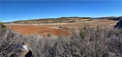
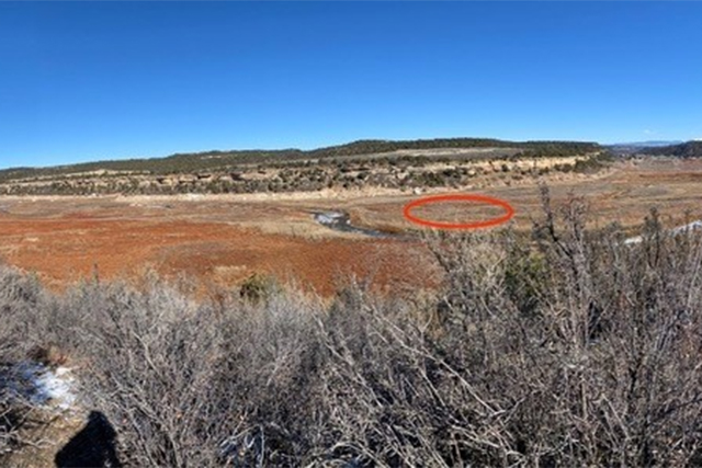
Panoramic view of the Dolores River Valley taken November 16, 2022, by Tom West.
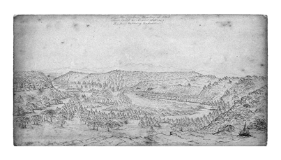
The picture is taken to the northeast. To the right the river is flowing on the south side of the valley. The river bends to the north side of the valley at the center of the picture. The camp would be in the valley in the right third of the photo. The same general course of the Dolores River can be seen in a 1965 map, a 1952 aerial photo, and an 1859 sketch of the area from an early United States expedition.
This part of the river valley has been under water as an arm of the McPhee Reservoir that was completed in 1985. A prolonged drought exposed this part of the river bottom in the Fall of 2022.
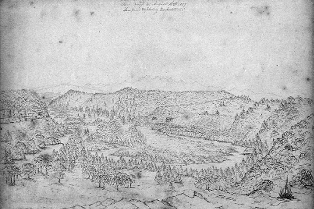
Charles Dimmock’s sketch shows the Dolores River Valley as it bends north near present city of Dolores, Colorado. The perspective is to the east looking at the La Plata Mountains. Permission to use this sketch was obtained from William and Mary Libraries.
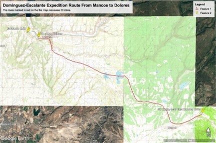
The proposed route of the Domínguez-Escalante expedition from their August 10 and 11, 1776, camp on the Mancos River to the camp in the Dolores River Valley near present day Dolores, Colorado. Several USGS 1:24000 Topographical maps were georeferenced to Google Earth to select what I believe was the best route based on topography.
